Information on this page has been provided by the Environment Agency and was correct at the time of upload. The Flood Hub is not responsible for any information held on this page.
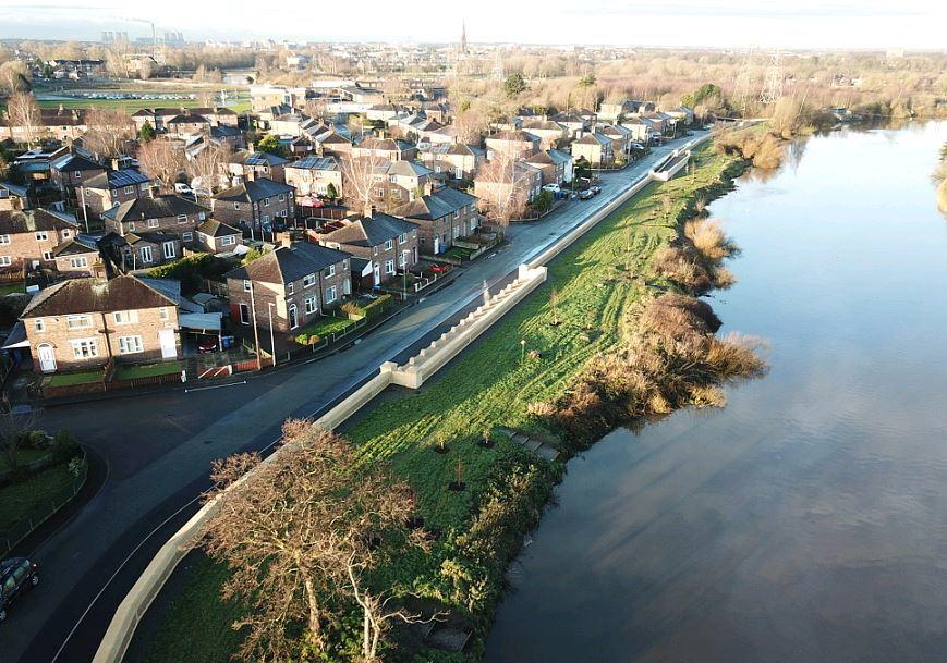
This scheme was completed in April 2018 but was officially opened in January 2018. The completed scheme has significantly reduced the risk of flooding from the River Mersey and its tributaries, with the risk now being a 1 in 100 chance in any year. The comprises of 5km of flood walls and 2.2km of embankment, the 7.2km scheme has improved amenity and recreational opportunities, as well as habitat conditions along the river corridor.

The 2009 National Flood Risk Assessment showed that Warrington had the tenth highest number of properties at significant risk of flooding in the country. Warrington is at fluvial and tidal flood risk from the river Mersey and its tributaries.
The Environment Agency’s £34 million flood risk management scheme, which was delivered between 2012 and 2017, has provided improved flood protection to approximately 2,400 local homes and businesses.
In addition, the scheme protects vital infrastructure, such as the Scottish Power High Voltage Grid Substation on Howley Lane, which serves approximately 2/5 of Warrington.
The completed scheme has helped to bring investment to the area. As a direct consequence of the flood alleviation scheme, the Howley Quay area has been re-developed with affordable housing; and the scheme has been a catalyst for further investment in recreational facilities and amenity improvements at Victoria Park.
The Environment Agency worked in partnership with Warrington Borough Council (WBC) and Scottish Power (SP) and other local stakeholders to deliver this scheme. Although the majority of the funding for the scheme was from Government Grant-in-Aid, substantial funding and “in-kind” work contributions were received from both WBC and SP and these were essential for the success of the scheme.