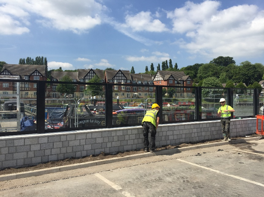
The market town of Northwich sits at the confluence of the River Dane and the River Weaver and has flooded on several occasions, from a variety of sources including main river, surface water and the sewer network. This has caused distressing times for residents as well as costing millions of pounds worth of damage to homes and businesses.
To reduce the risk of flooding, the Environment Agency in partnership with Cheshire West and Chester Council invested in a Flood Risk Management Scheme using a combination of flood walls, flood embankments, flood gates and demountable (removable) defences within the town centre.
The 1.7km of flood defences used a variety of materials and methods to offer best protection to the 400 homes and businesses in the town centre, including granite and sandstone to clad the flood walls and toughed glass panels (with a self-cleaning finish) to retain connectivity between the rivers and the adjacent land. This high-quality finish enhances the character of the town and aimed to attract new visitors and investors into Northwich.
In addition, a floating ecosystem was implemented in the town centre to soften the appearance of the flood wall and also to provide habitat for the various wildlife that frequent both rivers. Children from Witton Church Walk Primary School were invited to help with the implementation of the ecosystem by getting their hands dirty planting various grass and flowers.
Further upstream at Whalley road playing fields, an embankment has been engineered into existing high ground, so that the defence blends into the existing landscape. This is a good example of working with the local environment to ensure no additional barriers are created for people or wildlife. The shape of the bank has also been carefully designed with shallow side slopes so that it looks natural.
The scheme officially launched on the 30th June 2017. The scheme itself is also the result of partnership working between the Environment Agency, Northwich Town Council, Cheshire West and Chester Council, Northwich BID and the Canal and Rivers Trust as well as local businesses and the wider community.
The sewer flooding that occurred in the town centre during Storm Christophe is still being investigated but in the interim, over-pumping contingency solutions have been put in place.

Northwich Flood Defence Scheme

Plan showing location of Northwich Flood Scheme Defences