Watercourses that are at risk from flooding extremely quickly following heavy rainfall.
Flash flooding is often associated with surface water flooding, when drains are unable to cope with heavy rainfall. Flash flooding can also occur from watercourses which are very responsive to heavy rainfall. These watercourses are within drainage areas called ‘Rapid Response Catchments’ and are at risk from responding extremely quickly to heavy rainfall. Often this is due to steep valley slopes or in urban areas where water runs off the land straight into the river.
Precisely where flash floods will strike can be difficult to predict accurately as heavy rainfall can be very localised. Flash floods can even occur on sunny days when a storm has struck higher ground upstream. This means that it is important to be aware of the signs of flash flooding even on dry days.
Unlike most other types of flooding, the localised nature and speed of the river response means that flooding can occur before flood warnings are issued. It is therefore vital that you know what to do and how to stay safe.
Examples of the devastating effects of flash flooding were seen in Boscastle (Cornwall) in 2004; Helmsley (Yorkshire) in 2005; Coverack (Cornwall) in 2017 and Reeth (Yorkshire) in 2019.
Check your flood risk and sign up for flood warnings at https://www.gov.uk/check-flood-risk or call Floodline on 0345 988 1188.
As flash flooding can occur before flood warnings are issued it is important to be aware of the warning signs:

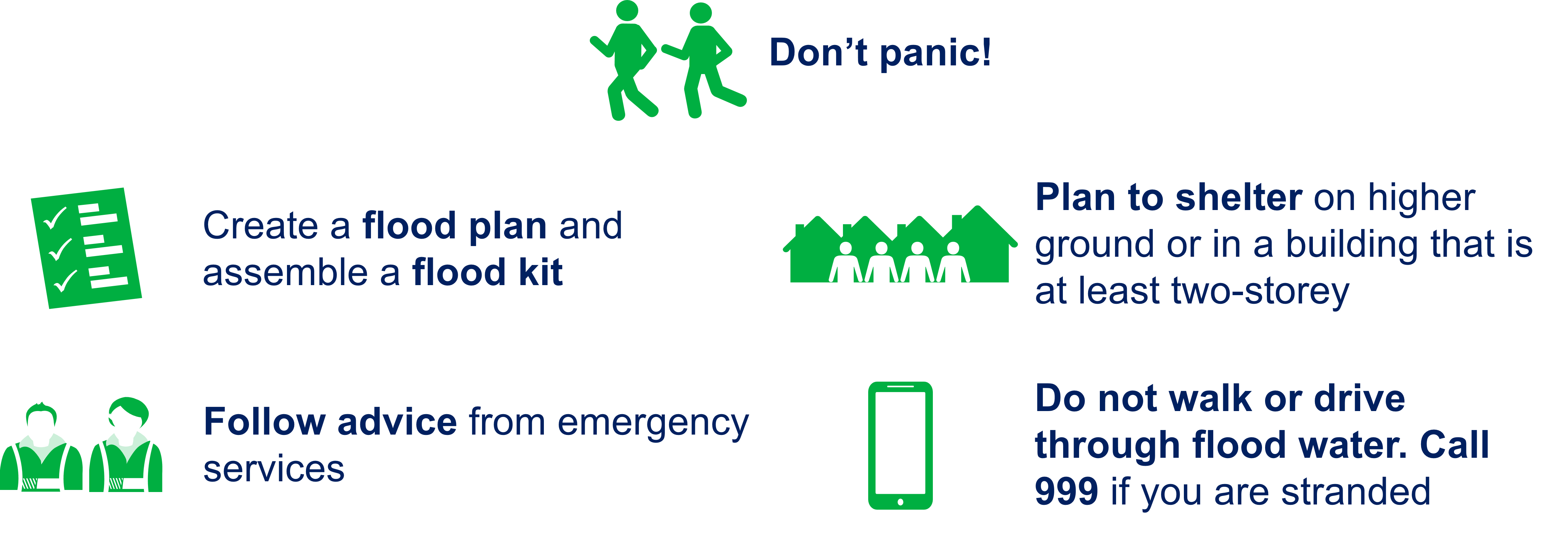
You need to take steps to prepare for flooding in advance so that you can respond quickly and calmly when it happens. This is especially important for flash floods as there is little time to respond when they do happen.
Visit https://thefloodhub.co.uk/household/ to find out more about creating a flood plan.
You can download all of this information in a handy PDF leaflet here.
Rapid response catchments are shown on the map as blue markers. Click on a marker to find out which watercourse in the area is at risk. There is a search bar to find a certain location or you can zoom in and out using your cursor or the buttons on the map menu. Only rapid response catchments in North West England are shown.
The watercourses highlighted were categorised by the Environment Agency as being at risk from responding rapidly to intensive rainfall. This risk is based on factors which include the depth of rainfall, amount of runoff, flow velocity and flow depth. In addition, the impact of flooding in a rapid response catchment may be increased due to the high debris loads that are associated with these catchments.
The information on this page has been provided by the Environment Agency and was correct at the time of upload.


