This blog has been written by The Flood Hub People.
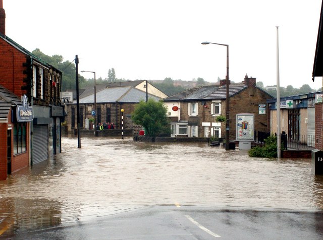
When people think about flooding, many immediately picture rivers bursting their banks. But are you at risk of surface water flooding without even knowing it? Surface water flooding is actually the most common type of flood risk in the UK, threatening more people and properties than river or coastal flooding, and it can happen miles from the nearest watercourse, often in areas where people wouldn’t expect.
Surface water flooding, also known as pluvial flooding, happens when heavy rainfall overwhelms drains and sewers. The water can’t drain away through the ground or drainage systems quickly enough, so it flows over the surface of the land instead.
The severity of surface water flooding can be made worse by blocked road gullies, drains or sewers, saturated or waterlogged ground, dry and compacted soil and an increase in hard, impermeable surfaces such as tarmac, concrete or paving.
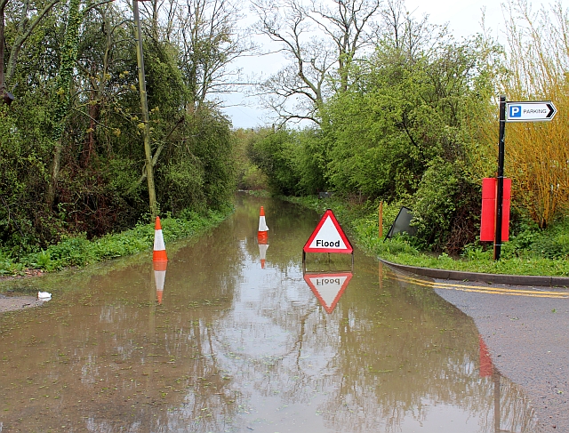
New Street flooded cc-by-sa/2.0 – © Bob Embleton – geograph.org.uk/p/2922279
Wondering if you’re in a surface water flood risk zone? You can find out by visiting: Where do you want to check? – GOV.UK (check-long-term-flood-risk.service.gov.uk) and typing in your postcode. The map shows the risk of surface water flooding for where you live, and you can also find out what other types of flooding you may be at risk from.
You’ll also find details of your Lead Local Flood Authority (LLFA), which is usually your County Council or Unitary Authority. They are responsible for managing the risk of flooding from surface water so if you experience surface water flooding, report it to your LLFA so they can investigate.
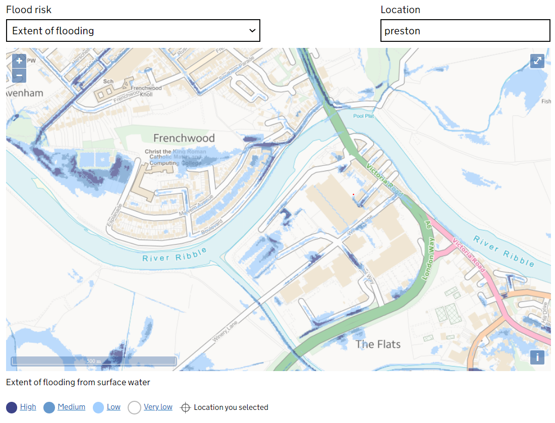
Image from the Environment Agency – Extent of flooding to an area
After periods of long and intense rainfall, soil can become waterlogged and saturated, meaning it can no longer absorb more water. This causes surface water flooding as the rain has to flow overland instead.
Conversely, after long dry spells, the ground may become baked an impermeable, where water is unable to infiltrate through the hard soil. This causes surface water flooding as water runs off the surface instead of soaking in. With climate change predicted to bring warmer and wetter weather, surface water flooding is expected to increase.
Urbanisation increases the risk of flooding by reducing the amount of natural land available to absorb rainfall. As towns and cities expand, green spaces are replaced with buildings, car parks, driveways and other hard, impermeable surfaces. This prevents rainwater from soaking into the ground, causing it to flow over the surface instead and increasing the likelihood and volume of surface water flooding.
Church Street Darton Flooded cc-by-sa/2.0 – © John Fielding – geograph.org.uk/p/469154
Surface water usually drains away through highway gullies and sewers, but these systems can easily become blocked by leaves, litter, silt or other debris. When this happens, water can’t drain away quickly enough, leading to localised flooding.
During intense or prolonged rainfall, even clear drains can struggle to cope. Excess water can exceed the system’s capacity, causing it to back up and flood nearby streets or properties. As climate change brings more frequent and heavier downpours, many older drainage networks are becoming increasingly overwhelmed due to their limited capacity.

Leaves blocking a drain
The natural shape and slope of the land, known as topography, plays a key role in surface water flooding. Areas located within steep-sided valleys are more vulnerable, as rainwater runs downhill quickly, gathering speed and volume.
In contrast, flatter landscapes allow water to move more slowly, giving it more time to soak into the ground or be intercepted by vegetation, trees and natural dips in the land.
Reducing surface water flood risk involves using a combination of natural processes and engineered solutions to manage rainfall more effectively. These approaches aim to slow the flow of water, increase infiltration, and store excess rain before it causes problems.
Natural Flood Management (NFM) uses nature-based solutions to reduce the volume and speed of surface water runoff before it reaches areas at risk of flooding. These techniques work with the landscape to temporarily hold, slow down, or absorb rainfall.
Common NFM techniques include:
These rural solutions help water soak into the land or be stored upstream, reducing downstream flood risk. For more information on these rural techniques, download our resource: click here.
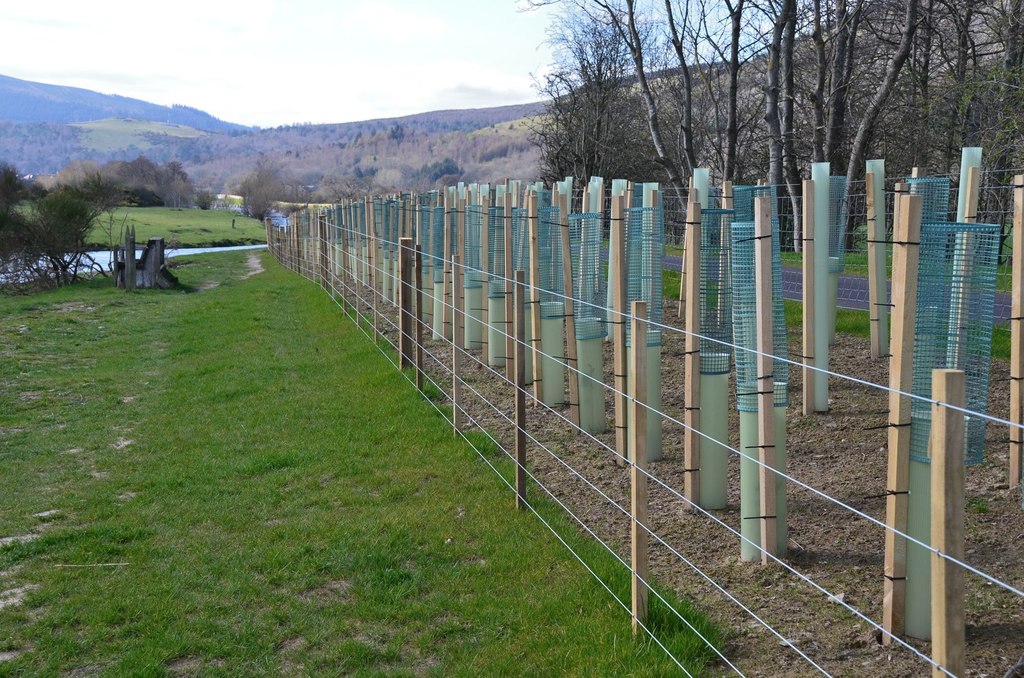
Newly planted trees by Walkerburn cyclepath cc-by-sa/2.0 – © Jim Barton – geograph.org.uk/p/6104424
Sustainable Drainage Systems (SuDS) are designed to manage rainfall in urban and developed areas by mimicking natural drainage. Rather than allowing water to rush into the sewer system, SuDS encourage it to infiltrate into the ground, evaporate, or be stored for slow release.
Examples of SuDS include:
Information on the different types of SuDS can be found in our booklet which can be downloaded here.
You can take small but impactful steps to reduce local flood risk:
For more information on local interventions to reduce surface water flood risk, click here.
Unfortunately, surface water flooding is not covered by the Environment Agency’s official Flood Alert and Warning Service. These warnings are for main river and coastal flooding only.
However, you can sign up for Met Office weather warnings for your area, especially during periods of forecasted heavy rain: www.metoffice.gov.uk/weather/warnings-and-advice/uk-warnings.
There is also an option of community telemetry systems, which provide more localised flood alerts.