The Environment Agency is delivering a proposed Flood Risk Management Scheme to better protect homes and businesses from flooding in the Kent catchment, and improve the local environment and community amenities. Kendal is the first area to be delivered, followed by Burneside, Staveley, and Ings, and upstream measures including flood storage. In addition, Natural Flood Management measures are being integrated into the plans which aim to slow the flow of water and provide wider environmental benefits across the catchment.
Please scroll down for further information.
Upstream measures are an essential part of the Flood Risk Management Scheme and the Environment Agency’s aim to provide a 1 in 100 year standard of protection to homes and businesses in the Kent catchment. The upstream storage element aims to provide flood storage which will enable all linear defences through Kendal, Burneside, Staveley and Ings to be built to a height that is acceptable for the local area and the community.
A catchment drain diverting flows from Stock Beck East and North tributaries into the River Mint will help limit and control the volume of water flowing from the upper catchment into residential areas of Kendal.
Natural flood management, also known as NFM and slow the flow, does form part of the proposals and is complementary to the proposed traditional engineered measures. NFM as a stand-alone option will not provide the level of flood protection needed for communities within the Kent catchment. This is because there are a number of limitations which include suitable land capacity, large scale land management changes and cost.
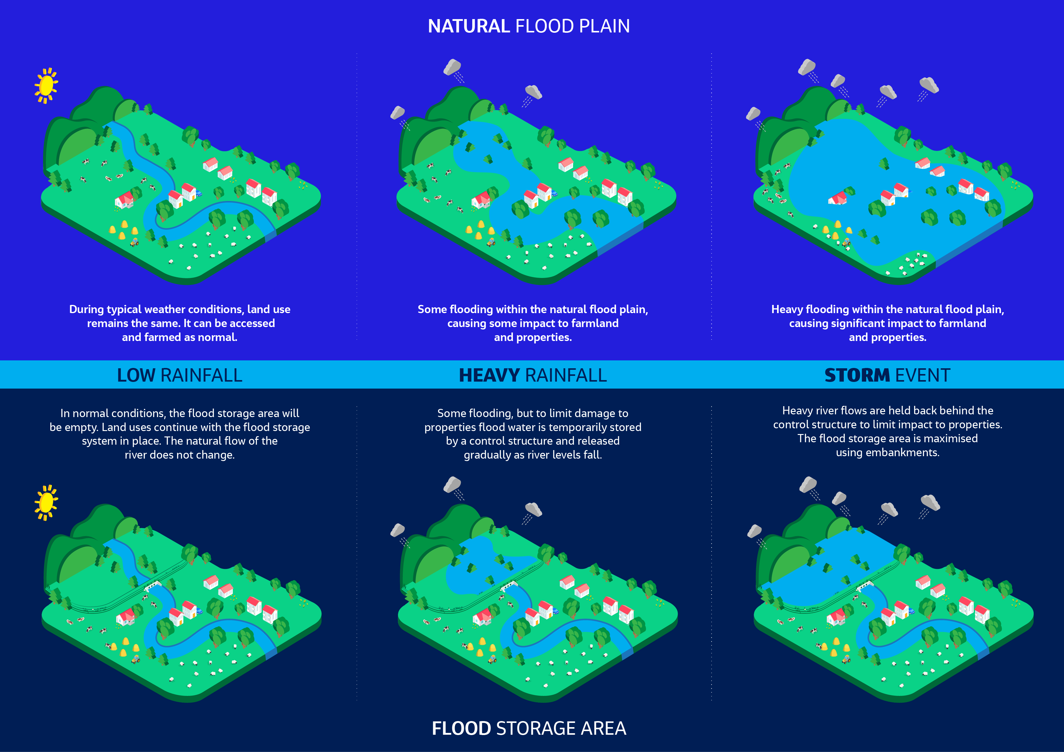
The Environment Agency are identifying potential flood storage locations in the Kent catchment. Upstream storage combined with linear defences is essential in reducing flood risk to downstream communities, decreasing this risk to the equivalent of a 1% chance of flooding in any given year. Proposed upstream storage areas will maximise the existing natural flood plain in storm conditions and temporarily hold excess water.
The design and construction of flood storage areas is complex, there are Standards and Acts that designers must meet throughout the design process (for example the Reservoirs Act, Eurocodes and British standards). The ground conditions need to be fully understood so that the design team can assess the suitability of the combination of measures required to reduce flood risk as part of a flood risk management scheme. The process involves a significant amount of desk-based study before a site-specific survey can be undertaken.
Site surveys and ground investigations are important; they allow engineers to understand the existing natural processes which are occurring in the study area, for example groundwater flow, surface water flow and fluvial activity. They provide detail on the composition of the ground and what impact that might have on the proposals. Ground investigations also allow engineers to conduct an array of testing both at the time of the survey, and on samples in the laboratory. This enables a deeper understanding of how the ground will behave, and what the potential impact might be on the proposed flood risk measures.
Upstream flood storage areas maximise the existing natural flood plain in storm conditions to temporarily hold excess water, reducing flooding to properties downstream. Generally, flood storage areas are designed so that the land use can be retained during normal conditions and will only be utilised to hold excess flood water temporarily in extreme storm conditions.
Flood storage areas generally consist of raised earth embankments and a control structure. The earth embankments temporarily contain the flood water within the natural flood plain during extreme high river levels. A control structure is used to control the volume of water released from the flood storage area and manage flow downstream. Any proposed storage areas are designed and landscaped to blend in with the natural environment. The River Kent is ecologically very important. Working with others, we want the scheme to enhance the quality of the riverine environment and wildlife within the upper reaches, whilst reducing flood risk.
Click the image to view a larger version.
This visual illustrates the complexity of the geology within the Kentrigg study area which, due to the significant depth of bedrock (varying between 4 and 25 metres), and high permeability (meaning water can flow through quickly), brings with it additional challenges to the design and construction of flood storage. The Environment Agency will continue to conduct further works to identify an alternative location that has better geological conditions, is less expensive, easier to design and deliver, and will have less visual impact on the surrounding landscape. More information can be found here.
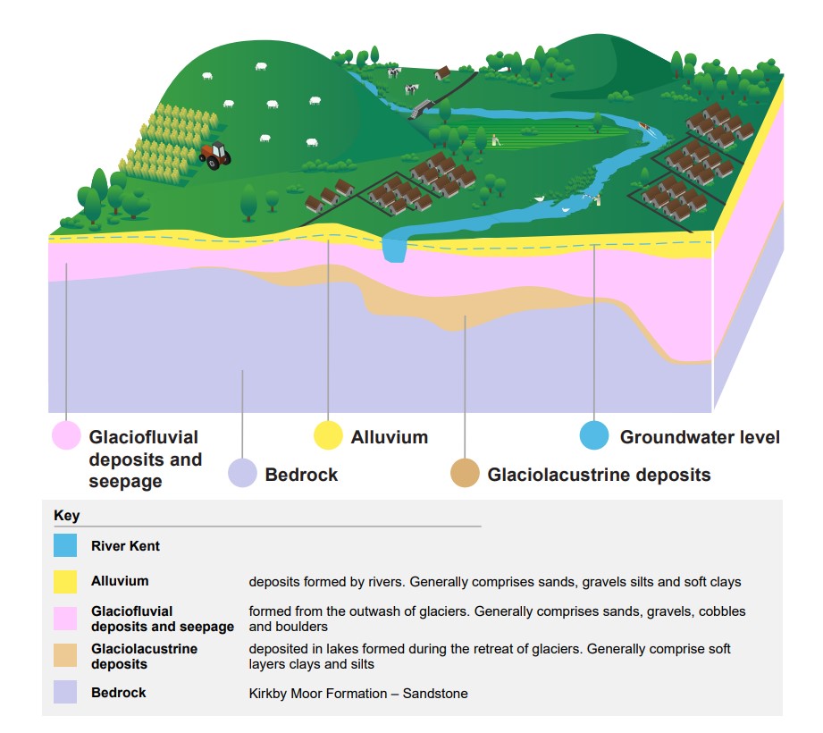
Kentrigg cross-section – geology findings
Natural Flood Management (NFM) involves using various techniques to restore or mimic natural functions of rivers, floodplains and the wider catchment. It aims to store water in the catchment and slow the rate at which water runs off the landscape into rivers, to help reduce flood risk to communities downstream. NFM can also be referred to as ‘working with natural processes’, ‘slow the flow’, ‘sustainable land management’ or ‘upstream management’. NFM measures will be complimentary to the linear defences and the proposed upstream storage.
Whilst the Environment Agency cannot provide the flood risk benefits from delivering NFM alone, they are committed to identifying opportunities to deliver projects where they have landowner permissions and a delivery partner. The Environment Agency is already supporting a number of projects and working with other organisations and landowners to identify new opportunities for delivery in the future. There are currently four projects underway to improve the local environment, attenuate and slow the flow in the Kent catchment area.
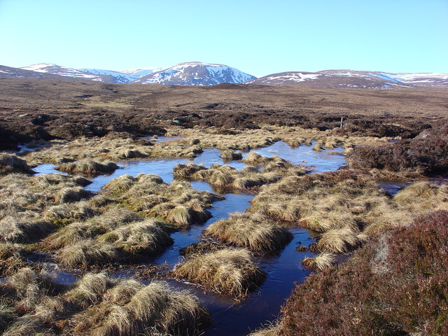
The Environment Agency are committed to working with natural processes as far as possible to make catchments resilient to climate changes. Working in partnership with Cumbria Wildlife Trust as part of the Cumbria Peat Partnership, Kendal Flood Risk Management Scheme has committed to delivering 50 hectares of peatland restoration in the uplands of the Kent catchment.
Peatlands are formed from bog moss called Sphagnum. Functioning blanket bogs provide a number of benefits including:
Most of the blanket bog in the Lake District has been damaged and is not able to function as it should. Restoring these peatlands by re-vegetating bare peat, blocking drainage channels and increasing the amount of Sphagnum in the uplands can have real flood alleviation benefits as sphagnum can hold up to 26 times its own weight in water!
Peatlands can help to prevent flooding by slowing down the speed by which water reaches rivers and streams in times of high rainfall. In periods of dry weather, peatlands also provide slow release of water to rivers and streams helping to prevent these from drying up.
Cumbria Wildlife Trust and the Environment Agency have a lot of experience in peatland restoration and 992 hectares of blanket bog have been restored across Cumbria over the last 3 years. The Kendal Flood Risk Management Scheme has created an opportunity to expand this work into the Kent catchment.
Work will take place in parallel with the main scheme and will include a monitoring programme to record the changes in wildlife and water flow that result from the project.
For more information on the peatland restoration project click here.
As well as providing protection against flooding, this peatland restoration scheme will also provide a number of other benefits for the environment.

Wildlife: There are many species of wildlife that are specialist to the acidic and nutrient poor qualities of peatlands. Cumbrian peatlands provide a great space for this wildlife to thrive.
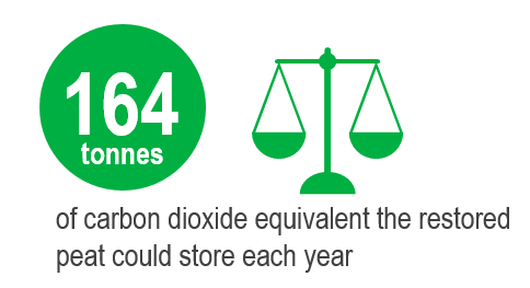
Carbon Storage: Peatland is the UK’s largest carbon store. The peat restored in this scheme could store 164 tonnes of carbon dioxide each year.
Water Quality: Peatlands are great at filtering rainwater and provide 70% of the UK’s drinking water.
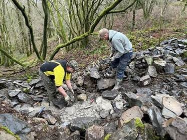
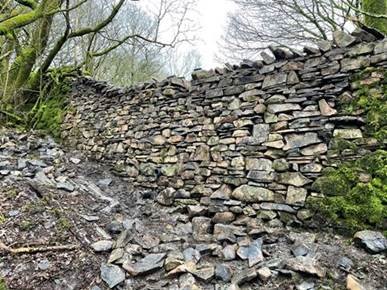
The Environment Agency have worked with project leads South Cumbria Rivers Trust to delivering a three-phased project that aims to ‘test and trial’ new techniques to reduce flood risk for rural communities. This project includes:
For more information on this project, visit the South Cumbria Rivers Trust website here.

Culvert works
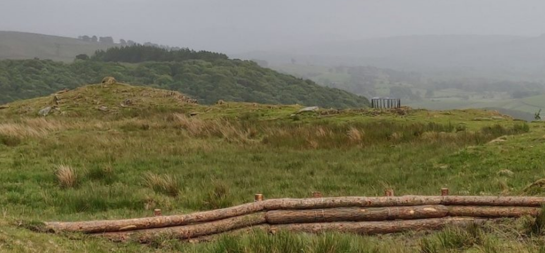
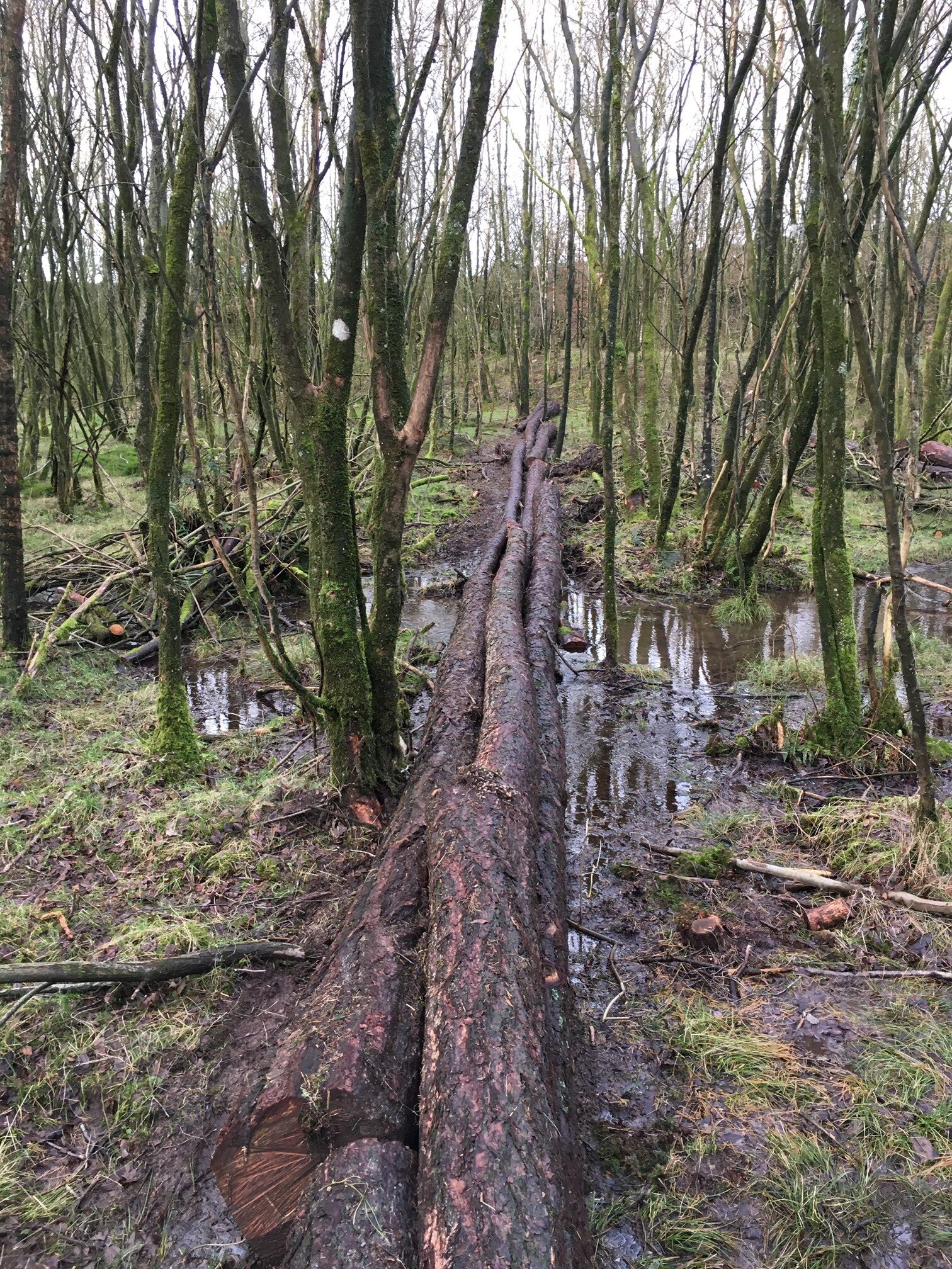
Leaky dam

Kerplunk feature
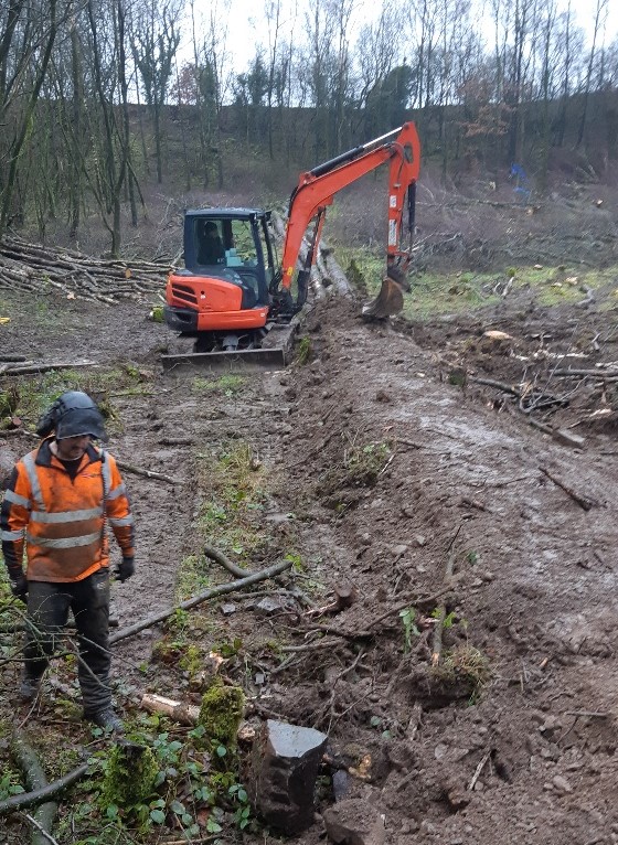
The Environment Agency are working with project leads Cumbria Wildlife Trust, along with United Utilities and local landowners, to reduce the risk of flooding to the community of Kendal using more natural solutions rather than traditional flood defence schemes. By creating a wetter environment and by planting a wide variety of trees the project will also greatly improve the range of habitat on the land, creating multiple benefits for the environment.
Working with farmers
One aspect of the project is working with the farming community to look at options to reduce the flow of water including sub-soiling which also improves water infiltration and soil quality, and re-routing flows away from pressure areas.
United Utilities land
The project is also working on United Utilities owned land with their support, and much of this work has been done by the Kendal conservation volunteers.
There are permitted pathways through the land, and people are discouraged from walking on the structures as over time it could damage them and reduce their effectiveness.

The Environment Agency have worked with project leads South Cumbria Rivers Trust and landowners Westmorland and Furness Council (formerly Cumbria County Council and South Lakeland District Council) as part of the Defra funded Cumbria NFM programme to deliver an exciting urban NFM project in the heart of Kendal, South Cumbria.
The Kendal Town View Fields project site is being used to test how effective and viable NFM techniques are in urban areas to reduce peak flows during storms events. Some aspects of the project include:
For more information on this project, visit the South Cumbria Rivers Trust website here.
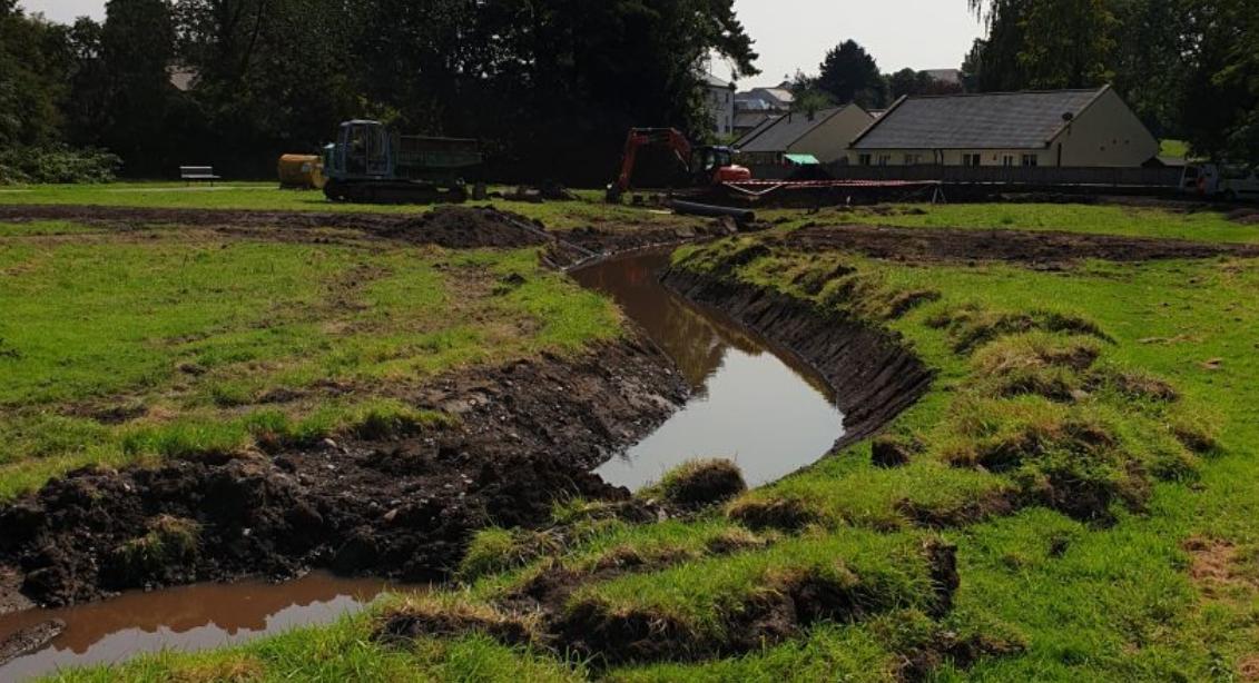
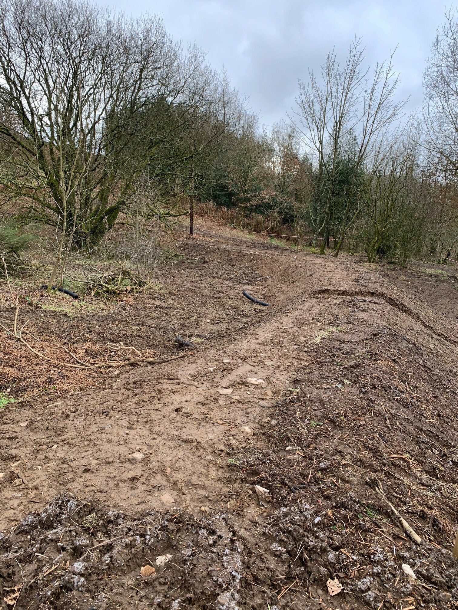
Construction of new channel
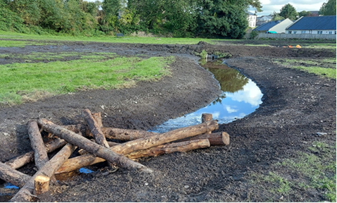
Example “kerplunk” attenuation feature


