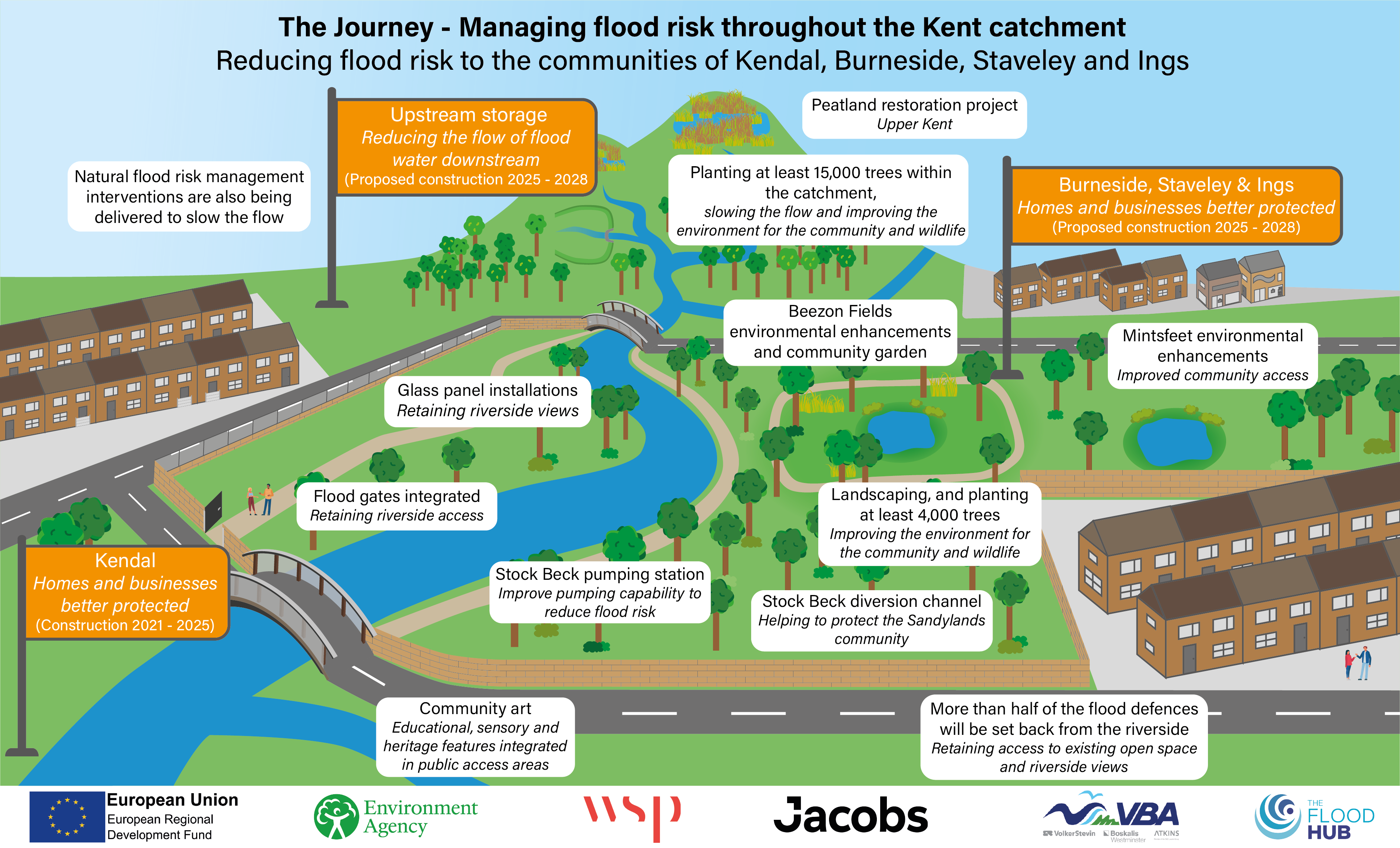
The Environment Agency is delivering a proposed Flood Risk Management Scheme to better protect homes, businesses and communities from flooding across the Kent catchment, while improving the local environment and community amenities.
Kendal Town is the first area to be delivered, with the upstream communities of Burneside, Staveley and Ings, including flood storage, forming later stages of the scheme. In addition, Natural Flood Management measures are being integrated into the plans which help slow the flow of water, store water in the landscape, improve habitats and biodiversity, whilst providing wider environmental benefits across the catchment.
Please scroll down for further information.
 The Upper Kent catchment, which includes the tributaries of the Gowan, Sprint, Mint and Stock Beck tributaries has a long history of flooding which was experienced most severely during Storm Desmond in 2015, when 2,276 properties and businesses in Kendal, Burneside, Staveley and Ings were flooded.
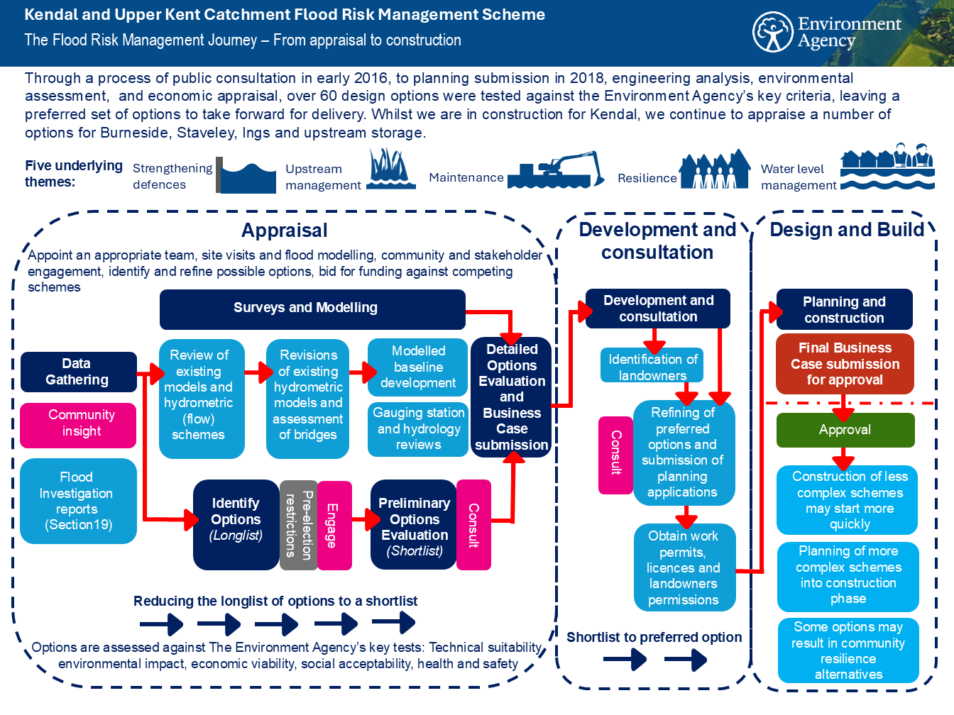
Since the flooding in 2015, the Environment Agency working closely with Westmorland and Furness Council (formerly Cumbria County Council and South Lakeland District Council), United Utilities and many other partners, including the local community, has carried out extensive investigations into how best to reduce flood risk across the catchment.
Over 60 different options have been explored and each assessed for:
In September 2018 the preferred options for Kendal and the Upper Kent catchment were presented and included a combination of measures, such as raised linear walls and embankments, conveyance improvements and upstream storage.
This combination of measures provides a balanced, catchment wide approach that reduces flood risk whilst respecting the local environment and landscape.
The scheme is being developed using an adaptive pathways approach meaning it flexible and can evolve over time. As the Environment Agency learn more about how the catchment responds to changing weather patterns and the effects of climate change, flood risk management measures can be adjusted or added when they are most needed. This helps ensure that the right interventions can be introduced at the right time, to maintain long‑term resilience for local communities.
A significant multi-million‑pound investment in this combination of measures will reduce the risk of flooding to a 1% chance in any one year for 1,921 homes and 2,250 local businesses employing 6,105 people across Kendal, Burneside, Staveley and Ings. This investment will protect a local economy worth £277 million and reduce flood damages by £880 million.