Drainage and culvert modifications have been completed at King Street, which reduce the chance of blockages and overflowing. Drainage improvements have been completed at The Sands and drainage investigations are ongoing at Broad Lane.
The Whalley & Billington Flood Action Group has worked hard to improve community resilience. This includes, but is not limited to, communications including a strong presence on social media, preparations prior to heavy rainfall and action during/after flooding. For more details regarding the Flood Action Group please visit, https://whalleyandbillingtonfloodactiongroup.wordpress.com/.
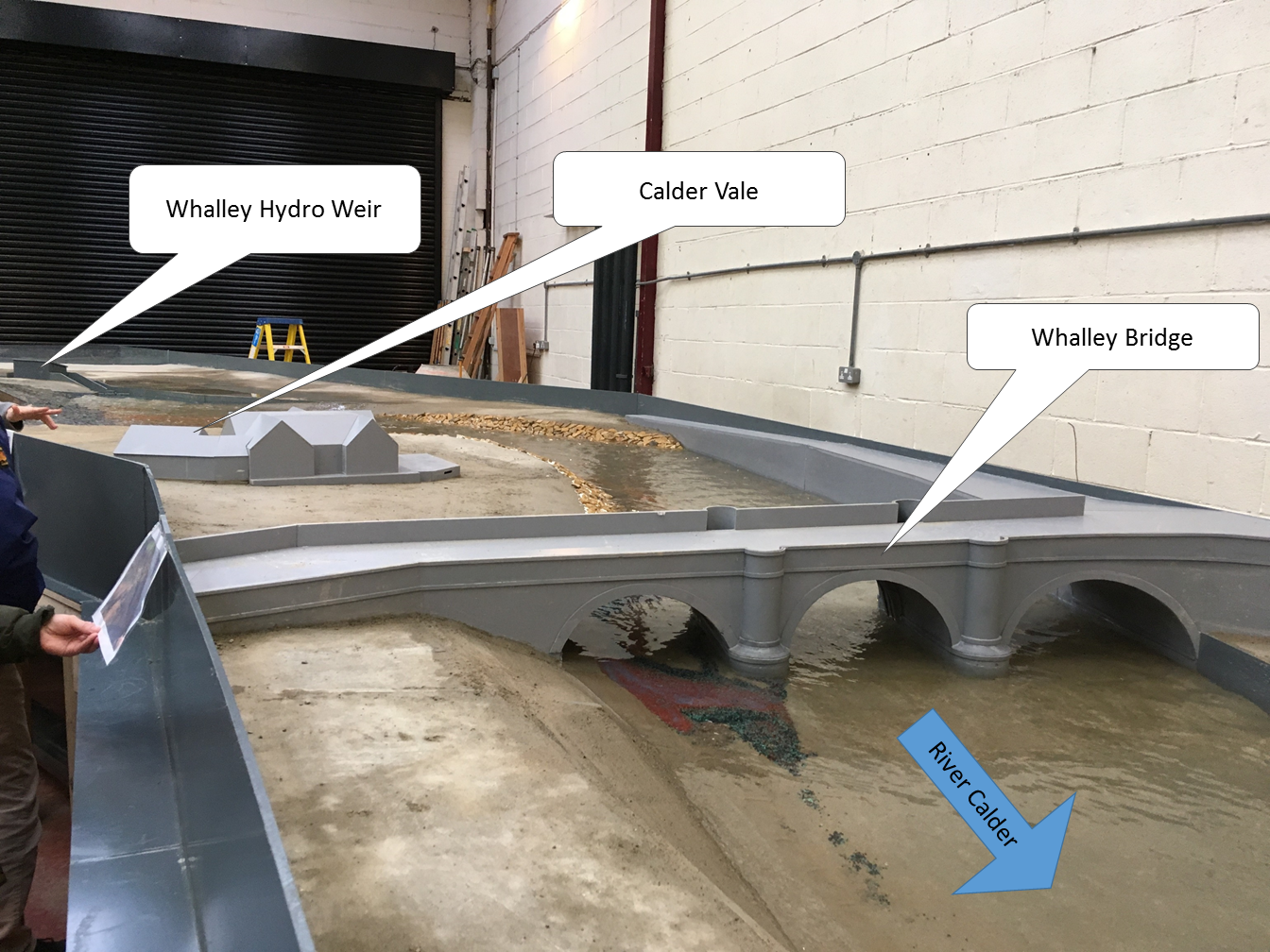
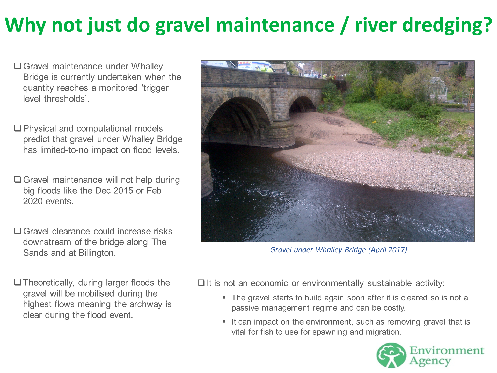
Gravel has been monitored and maintained when necessary under Whalley Bridge. A physical model representing the River Calder has informed the thresholds and frequency of gravel maintenance. The study has confirmed that the gravel has minimal to no widespread impact on flood risk across Whalley.

Physical Scale Model of River Calder at Whalley (Hydrotec consultants, 2018)

Overview of gravel maintenance under Whalley Bridge’
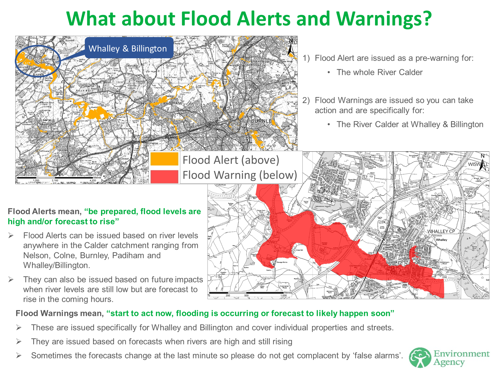
Flood Alerts and Warnings continue to be monitored and issued. Community members at risk of flooding are encouraged to sign-up for these at https://www.gov.uk/sign-up-for-flood-warnings.
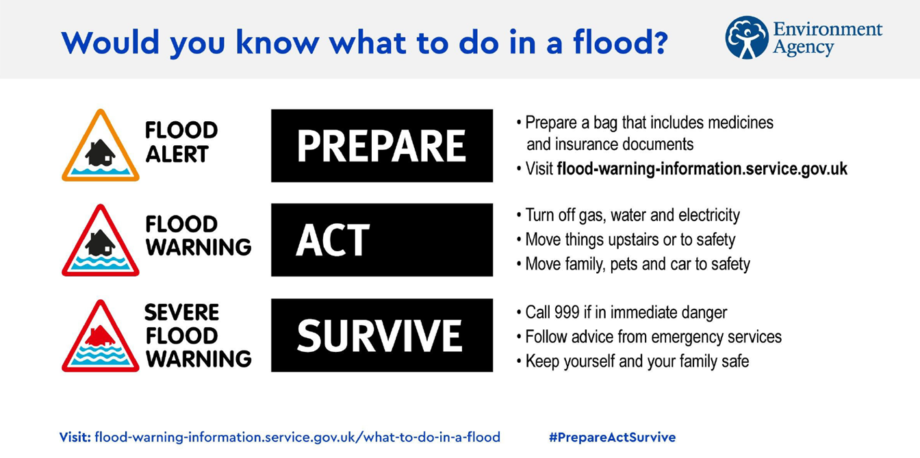
More information regarding flood resilience can be found at https://flood-warning-information.service.gov.uk/what-to-do-in-a-flood.
Would you know what to do in a flood?

Flood Alerts and Flood Warnings for Whalley
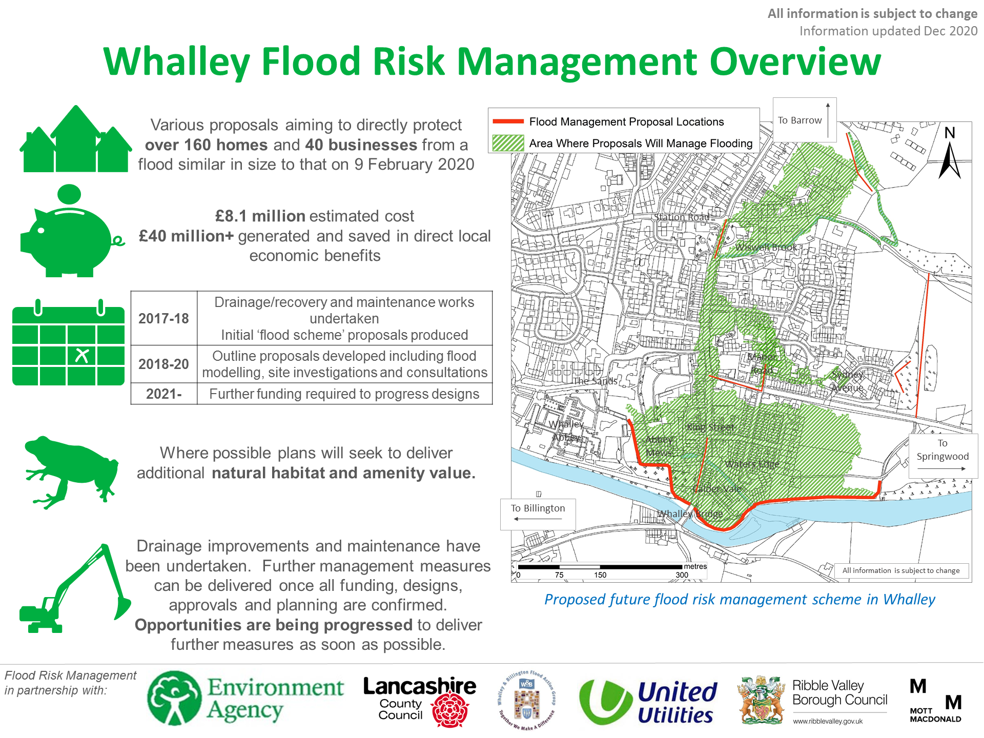
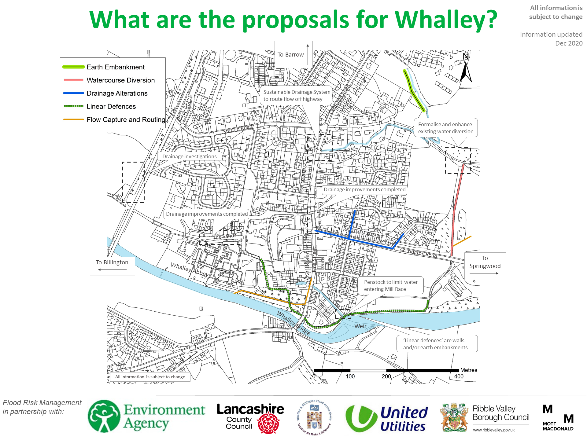
Plans for a Whalley Flood Risk Management Scheme started to be developed following the 2015 floods. These plans have been developed in partnership between the Environment Agency, Lancashire County Council, Ribble Valley Borough Council, United Utilities and Whalley & Billington Flood Action Group. In 2017-18 it was initially estimated that low-level flood walls along the River Calder and some minor works for King Street culvert would better protect Whalley from flooding. The details of these were shared at a community drop-in event in the village and via several newspapers.
However, more detailed investigations in 2018-19 have since concluded that these initial proposals would not provide sufficient protection. They would also result in higher flood risk for many properties in Whalley, especially around King Street. The plans have subsequently been revised to include additional and more substantial proposals. The details of those latest proposals can be found in the ‘Scheme details’ section.
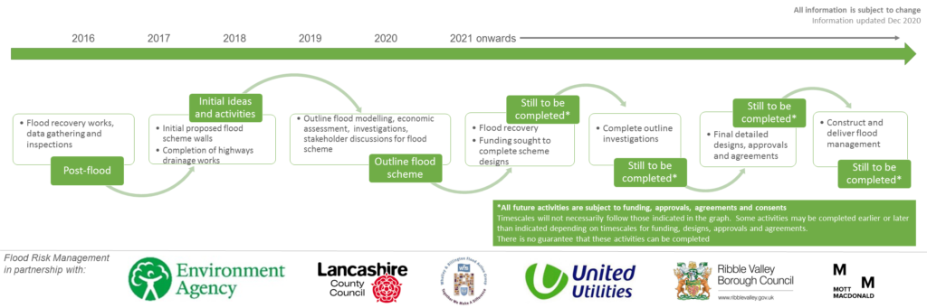
Timeline of flood risk management works in Whalley
Disclaimer: Timelines are indicative and based on the current best estimates
Statement from the Environment Agency regarding Coronavirus:
The Government has confirmed that construction and work activities can continue to operate during the current Coronavirus pandemic. To support the continued delivery of this we are working very closely with our delivery contractors to ensure they are working to the guidelines published and enforced by Public Health England.
It is vitally important that all of our activities operating during this period ensure they are protecting their workforce and minimise the risk of spread of infection. The measures that Public Health England have put in place ensure consistent measures on all sites of all sizes, especially recommendations around social distancing.
If an activity cannot be undertaken due to a lack of suitably qualified personnel being available or social distancing being implemented, it should not take place. We will ensure that our staff and contractors workforces at every opportunity are implementing Government guidance to protect them, their colleagues, their families and the UK population as a whole.
Undoubtedly, the Coronavirus has had huge impacts on our daily home and working lives and this has and will result in some delays to us delivering flood risk management activities across the country. These delays are particularly linked to supply chain delays, the ability of us mobilising and deploying people, access to equipment and materials as well as ensuring we can work in public places safely. We continue to progress the development of the flood risk management activities whilst following the guidance provided by the Government. Our activities within Whalley will strictly follow the guidance which can be viewed online at https://www.gov.uk/guidance/working-safely-during-coronavirus-covid-19/construction-and-other-outdoor-work.