This local spaces area provides a link to the ‘Your Local Area’ map. It contains information on any completed and ongoing flood schemes, natural flood management schemes, flood action and community groups established in your area and information on local events.
The information on this page has been provided by Risk Management Authorities and was correct at the time of upload.
Managing flood and coastal erosion risk requires many organisations to work together in partnership. County and Unitary Authorities have been made the Lead Local Flood Authorities (LLFAs) under the Flood and Water Management Act 2010 to take on the responsibility for leading on the coordination of flood risk management. They are tasked with bringing together all the relevant bodies to work in partnership to help manage local flood risk.

MightyTravelier / Lyme Park, Cheshire
To tackle flood risk in an integrated way the key agencies / authorities in water management across the sub-region combined as a Flood Risk Management Partnership in October 2010. By doing so it ensures the Partnership appreciates its actions over the whole area rather than simply within political boundaries.
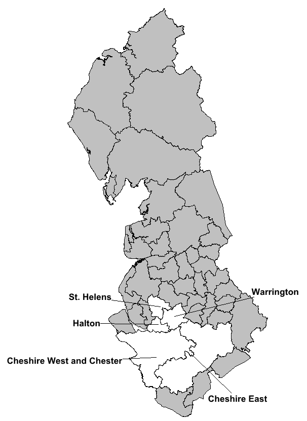
The Cheshire Mid-Mersey Partnership is one of five Flood & Coastal Erosion Risk Management (FCERM) Partnerships within the North West region, the remaining four are:
The Partnerships are in regular contact to actively deliver the duties set out by the Flood and Water Management Act 2010 which is overseen by the North West Regional Flood & Coastal Committee (NW RFCC).
The Cheshire Mid-Mersey partnership consists of the following Local Authorities. Further information on the roles and responsibilities, local flood risk management strategies and flood investigation reports are contained within the flooding sections of the authorities’ website.
| Local Authority Area | Residential Properties at Risk* | Non-Residential Properties at Risk** | ||
| Surface Water (1 in 100 year) | Fluvial Risk (Flood Zone 2 and 3) | Surface Water (1 in 100 year) | Fluvial Risk (Flood Zone 2 and 3) | |
| Cheshire East Council | 2,204 | 2,885 | 472 | 602 |
| Cheshire West and Chester | 1,773 | 2,459 | 289 | 1,143 |
| Halton Borough Council | 850 | 754 | 157 | 1,351 |
| St Helens Council | 1,683 | 688 | 1,855 | 112 |
| Warrington Borough Council | 884 | 15,681 | 163 | 1,600 |
| Total | 7,394 | 22,467 | 2,936 | 4,808 |
Values as of June 2017 supplied by the Environment Agency
*Includes properties situated on upper levels due to access issues.
**Includes properties situated on upper levels due to access issues. Non-residential properties are classified as having a function other than residential.

The Partnership has a critical role to play in managing the risk of flooding from all sources and in working with communities to help them become more resilient.
The Partnership provides a forum to enable Risk Management Authorities (RMAs), partners and communities to identify how they can work together to deliver a more integrated, efficient and effective flood risk management service.
The following areas have been identified as priority themes for joint working:
This is supported by a detailed action plan showing the activities that will be delivered by the Partnership.
The information on this page has been provided by the Cheshire Mid-Mersey Flood & Coastal Erosion Risk Management Partnership. Last updated: Summer 2024