Kendal homepage
These Key Facts documents give you a quick and informative overview of the features and benefits that the Kendal flood scheme will provide, along with key dates. Click to download.
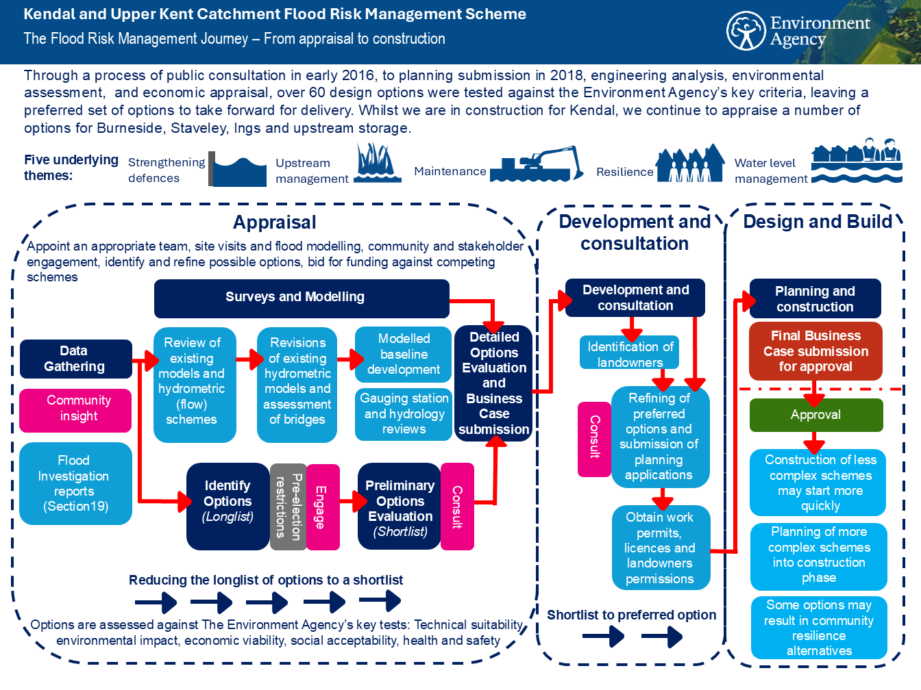
Through a process of public consultation, engineering analysis, environmental assessment and economic appraisal, over 60 design options were tested against four criteria leaving a preferred set of options to take forward for phase one of the Kendal Flood Risk Management Scheme. Find out more about the journey to delivering the flood scheme in this document.
The Environment Agency is delivering a Flood Risk Management Scheme to better protect homes and businesses from flooding in the Kent Catchment, and improve the local environment and community amenities. Kendal is the first area being delivered, followed by a proposed scheme for Burneside, Staveley and Ings, and upstream measures including flood storage and Natural Flood Management. Find out about the benefits being delivered in this document.
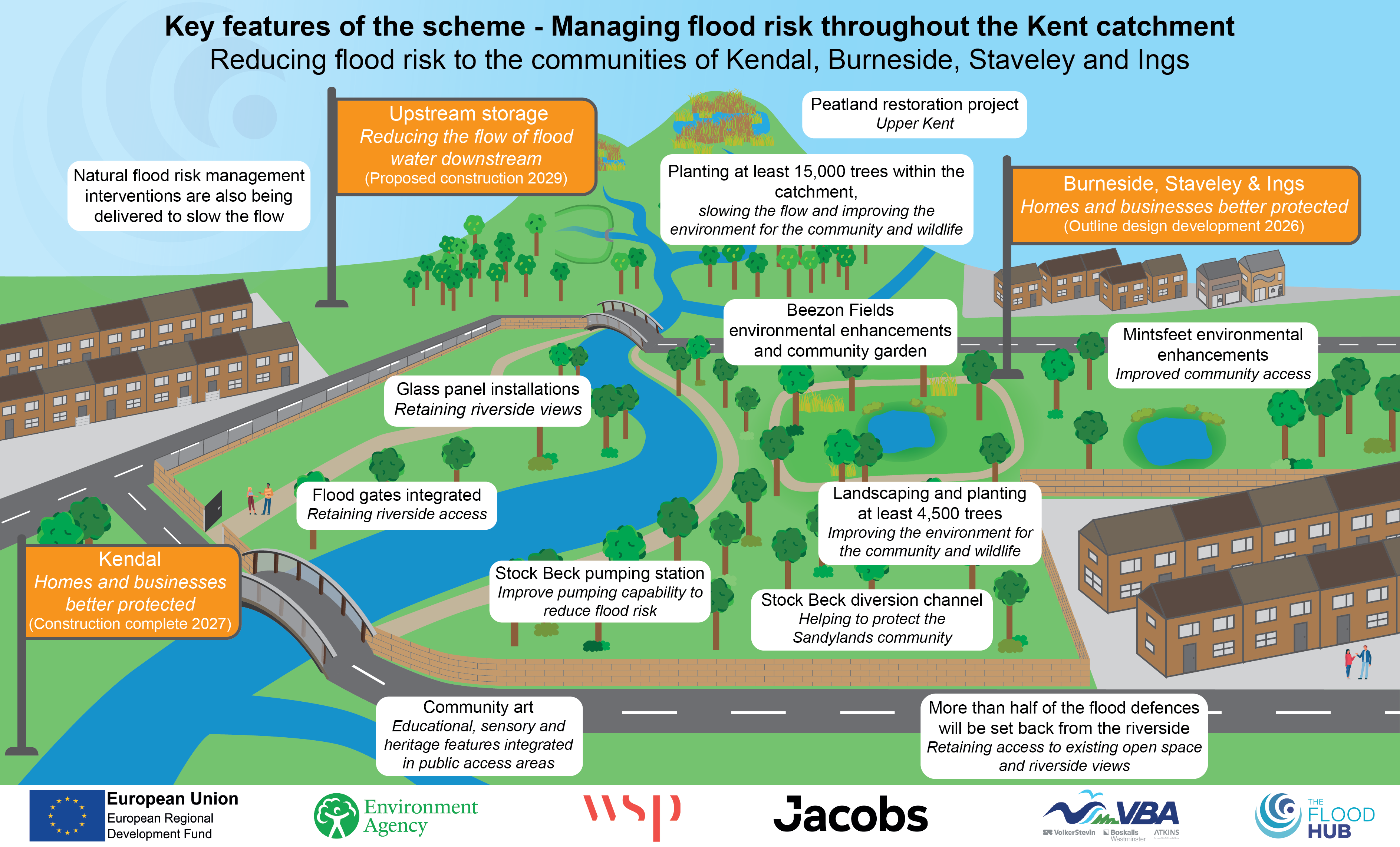
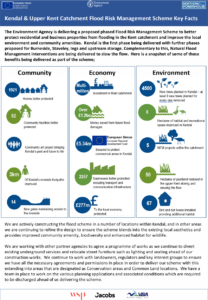
The Environment Agency is delivering a proposed Flood Risk Management Scheme to better protect residential and business properties from flooding in the Kent catchment and improve the local environment and community amenities. Here is a snapshot of some of those benefits being delivered as part of the scheme.
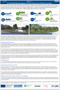
The scheme runs from Helsington Mills in the Southern end of Kendal to Mintsfeet in the Northern end of Kendal. The complex nature of delivering a long linear scheme through a busy town centre has led the Environment Agency to break down the scheme into a number of small sections termed as ‘reaches’. The order of work is influenced by minimising disruption within the town and ensuring the Environment Agency manage flood risk. Work will begin in the Southern reaches and then work up towards the Northern reaches, with a number of reaches being delivered at the same time. The ordering of these have been carefully considered to ensure minimal traffic or pedestrian disruption in and around the town. Find out more by downloading this document.
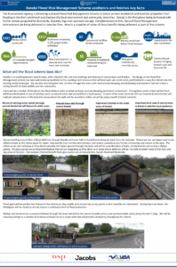
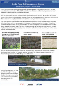
Kendal is an evolving historic market town, with a blend of old and new buildings and features of varied styles and finishes. The design of the Flood Risk Management scheme will be extremely sympathetic to this. Find out more by downloading this document.
The primary aim throughout construction works is to ensure Kendal keeps moving, and it is fundamental to how the Environment Agency order the delivery of works. There will be some disruption to areas along the riverside as they balance the need to keep contractors, the community, and visitors safe, whilst keeping disruption to a minimum. Download this document for more information on how the Environment Agency will do this.
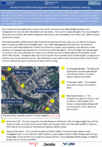
Since starting construction of the Kendal Flood Risk Management Scheme in February 2021, construction of flood defences in seven locations has been completed and the Environment Agency are continuing to construct flood defences in six locations within the town. Download this document for more information on the schemes progress.
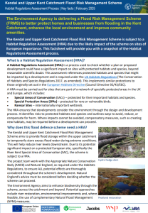
The Kendal and Upper Kent Catchment Flood Risk Management Scheme is subject to a
Habitat Regulation Assessment (HRA) due the likely impact of the scheme on sites of
European importance. This factsheet will provide you with a snapshot of the Habitat
Regulations Assessment process.
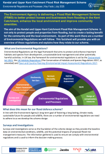
The Environment Agency adheres to a number of Environmental Regulations and processes as the Kendal and Upper Kent Catchment Flood Risk Management Scheme progresses. This fact sheet provides an overview of these regulations and explains how they relate to our scheme.
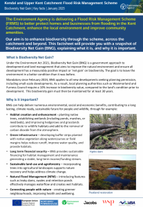
Here is a snapshot of some of what is known about the ecology of Kendal and the environmental improvements resulting from the scheme.
The Environment Agency aim to minimise the number of riverside trees that will be affected by the flood defence works, and continue to undertake careful assessments of all trees to determine whether there is scope to protect and retain them. Find out more by downloading this document.
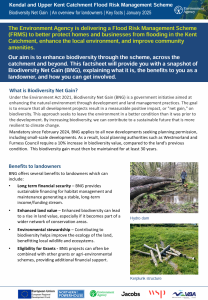
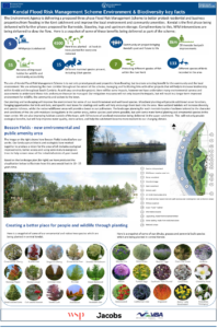
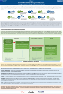
The aim of the Kent Catchment Flood Risk Management Scheme is to not only protect people and properties from flooding, but to create a lasting benefit for the community and the local environment. The Environment Agency plan to enhance the river corridor throughout the extent of the scheme and manage links with other projects helping to increase habitat and biodiversity. Find out more in this document.
The Environment Agency plan to enhance the river corridor environment throughout the extent of the scheme and with any other construction project, there will be some impacts. However, they have undertaken many environmental surveys and assessments and will continue to do so, to understand those risks and ensure they can be managed and mitigated. Find out more in the document.