The Environment Agency is delivering a proposed Flood Risk Management Scheme to better protect homes and business from flooding in the Kent catchment, and improve the local environment and community amenities. Kendal is the first area to be delivered, followed by Burneside, Staveley, and Ings, and upstream measures including flood storage. In addition, Natural Flood Management measures are being integrated into the plans which aim to slow the flow of water and provide wider environmental benefits across the catchment.


Click here to return to Kendal Flood Risk Management Scheme page
This section provides an overview of the Kendal flood risk management scheme which is currently in construction. It will showcase areas where construction is complete and where the riverside landscape and public amenity has been improved. For locations where construction is yet to begin, it will provide a summary of the proposed scheme design.
All of this information is also available as a downloadable book here Kendal Flood Risk Management Scheme – Design and Benefits Guide (PDF)

Riverside path to waterside cafe
The historic market town of Kendal has a blend of old and new buildings featuring a variety of styles and finishes. The design of the Flood Risk Management Scheme is sympathetic to this, and the Environment Agency has worked hard to ensure that all flood walls are built and finished in a way that blends into the existing, varied landscape.
All the flood wall finishes that feature within Kendal have received planning permission.
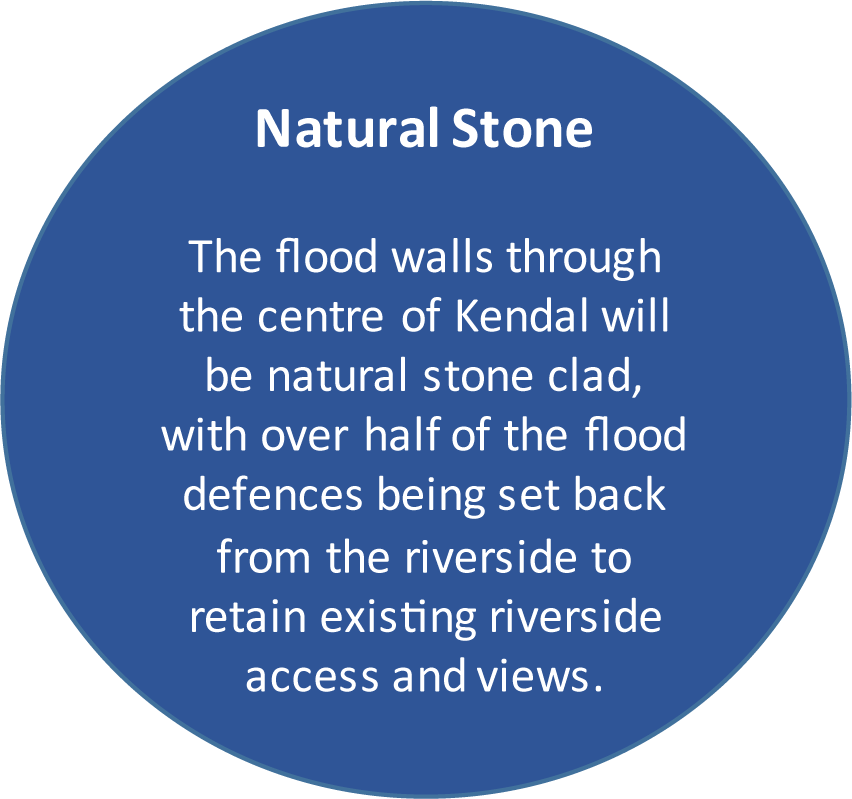
Walls in the centre of Kendal are made predominantly from re-using existing stone or natural stone cladding, sourced from a local quarry. However, in some of the outer areas of the town, imprinted concrete will be used which replicates natural stone, and in industrial areas where the walls will be much less visible, they will be finished in smooth concrete.
Around 6km of flood defences throughout Kendal are being built, with over half of these being set back from the riverside. Defences have been designed to be set back from the river where possible as this helps to make more space for water, improves the river corridor environment and retains riverside access.
The flood defences will not be one continuous wall. They are designed to blend naturally into higher ground through the town and will be a combination of walls, embankments and sections of integrated glass panels.
The glass panels are important in order to retain views of the river and key areas of interest. Glass panels are being installed at Gooseholme, Waterside, and Aynam Road.
Flood gates are another key feature of the scheme as they maintain public riverside connectivity and enable the Environment Agency access to maintain the riversides. Once the scheme is complete, during high river levels the flood gates will be closed providing a consistent level of flood protection through the town.
Are a common feature throughout the town that defines the extent of public access and maintains public safety along the river’s edge. Railings are being placed in a number of locations using a single style to provide consistency.
As part of the scheme, investment is being made into providing greater biodiversity benefits along the river corridor as well as improvements that the community and visitors to the area can enjoy.
The Environment Agency continues to integrate a number of key features into the scheme that enables important elements of the local heritage to be celebrated, installation of educational and art features in amenity locations, and landscaping and planting to improve biodiversity along the river corridor.
An extensive programme of engagement with local groups, schools, and local artists has supported the development of artworks, with commissioned sculptures being placed at Mintsfeet footpath, Mintsfeet Nature Area, Beezon Fields and Parish Church.
New riverside walking trails improve connectivity to the riverside and information boards showcase local biodiversity improvements, heritage information and signposting to local areas of interest.

The town centre is a conservation area. Conservation areas are designated for their special architectural or historic interest which have been subject to extra planning controls meaning property alterations, demolition and the felling or pruning of trees have required and subsequently received additional permissions.
In the southern most reaches of the Kendal Flood Risk Management Scheme are the communities of Helsington Mills and Watercrook.
These sit within a landscape which is of heritage importance that includes Laithes Mill Race and Leat which are considered part of the grade II listed structure.
A buried Roman Fort, and settlement of national importance can also be found here which is protected as a Scheduled Monument. The scheme has been designed and delivered in a way to avoid any impact to this monument with an archaeologist presence throughout construction to monitor all works in this location.


Glass panel flood walls are being installed in three central locations of Kendal. These feature at Waterside, Aynam Road and Gooseholme to retain existing riverside views and community connectivity with the River Kent.
The self-cleaning glass panels will be between 0.8m to 1m in height and sit within slimline stainless steel frames.
We are delivering a flood risk management scheme
that extends from Helsington Mills in the south of Kendal to Mintsfeet in the north.
The complex nature of delivering a long linear scheme through a busy town centre has led us to break down the scheme into a number of small sections we term as ‘reaches’. The map shows the locations of the different reach areas where works have been and will be occurring.
The order of work is influenced by minimising impacts to traffic and pedestrian movement within the town whilst ensuring we manage flood risk.
The working areas will be compact, balancing the need to keep the contractors, the community and visitors to the area safe. Some footpaths along the riverside will be temporarily closed whilst works take place in those areas, but alternative footpaths will be open in line with our Traffic Management Plan.
All road bridges will remain open for access at all times. There will be temporary lane closures on Aynam Road and on New Road. A road closure will be in place at Waterside whilst work takes place in these areas.
Tree assessment and appraisal process
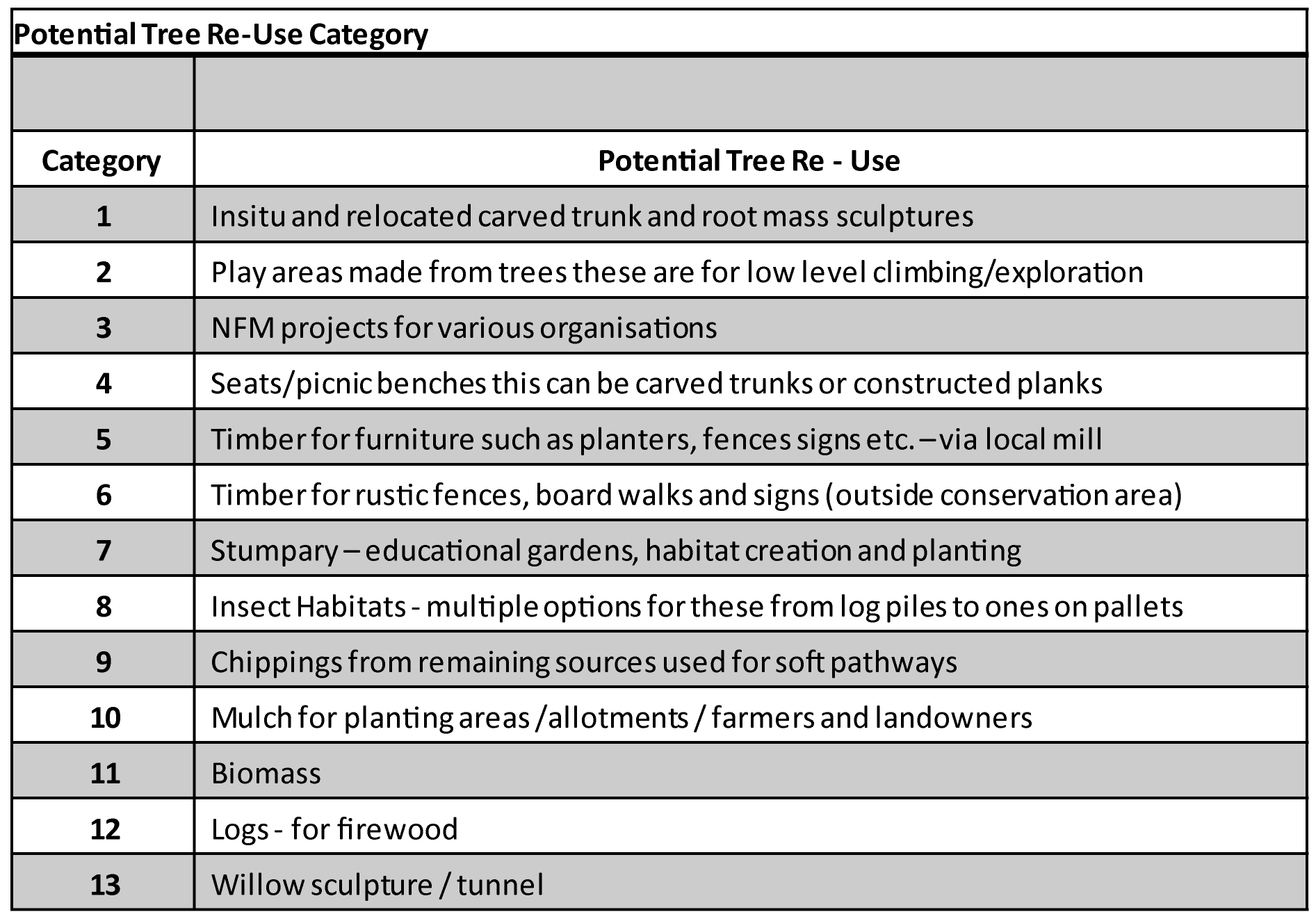
The tree assessment process is detailed and ongoing throughout the design and construction phases. As part of the assessment process, mitigation measures are identified ahead of any construction works and also the determination of the re-use options of wood from all felled trees and branch removal.
A range of techniques will be used in order to manage the tree and vegetation removal on site ahead of any construction works.
Trees that will be retained – Tree protection barriers will be installed to minimise the risk of damage to tree root systems, branches and trunks from soil compaction, contamination, construction works or vehicles.
Vegetation clearance and pruning – Ground covering vegetation will be removed to ensure the working area is clear. Some trees will require pruning to ensure there is safe clearance and space to work but will be protected from further impact. If trees are pruned they will be retained.
Coppicing – This is a process of cutting trees down to ground level and allowing the stumps to regenerate new growth over a number of years. This technique enables the tree to remain.
Soft felling – This approach will be used on trees that have been identified through the assessment process to have bat roosting potential. Soft felling will be undertaken outside of the bat roosting season. This technique involves removing small sections of the tree, carefully lowering to the ground and leaving overnight to provide an opportunity for bats to vacate the tree.
Felling – For tree removal (other than those to be soft felled) a sensitive approach will be taken to ensure limited impacts. Any trees that need to be felled will be done outside of the bird nesting season and appropriate checks will be made on site for any active nests prior to removal works.
The Environment Agency continue to assess the removal of any trees as a consequence of the scheme and continue to work hard to reduce this number. To date, through further assessments and refining the scheme design, the number of trees identified for removal has reduced from 779 to around 500. Work continues to reduce this number further.
Ahead of any construction there will be a number of preparation works to carry out. In some locations the Environment Agency are able to deliver the construction works more easily due to larger working areas, the works not being complex in their nature, and because there is little interference from underground services.
There are a number of locations however, particularly in the central areas, where a number of preparatory works are needed before construction can begin.
All the working areas need to be free from utility services and street furniture such as seating, bins and street lighting. Where it is known where underground services are located and street furniture and lighting needs to be removed, preparations are being made with the service providers to divert or undertake removal and relocation works. Some of the major relocation and service diversion works may require footpath closures / diversions and temporary lane closures on the highway.
The approved working hours will be Monday to Saturday from 8am to 6pm however, the EA’s aim is to work from Monday to Friday only. It is not anticipated that work will take place outside of these hours but if required, additional permissions will be applied for.
Throughout the construction of the scheme noise and dust levels will be monitored and managed to reduce any impact to homes, businesses, public areas, and the natural environment. Several monitoring techniques will be used and a range of measures to provide visual screening will assist with reducing noise and dust levels.
To manage any debris on the roads created by construction traffic, a full clean of the carriageway will be undertaken by a road sweeper or similar at a frequency that is appropriate.
Piling is an activity which will take place is locations where we need to create a strong foundation from which the new flood walls will be constructed. Piling can cause noise and vibration impacting homes and businesses within the vicinity. Noise and vibration mitigation will be in place during these works and will be consistently monitored to ensure levels remain within agreed tolerances.
There are dedicated routes for bringing in materials and plant to the site compound area and then distributing from the site compound to the various work areas. The construction traffic and delivery routes will access Kendal from Junctions 36 and 39 of the M6.
The compound area is located at Gilthwaiterigg Lane in the north of the town. The compound is also used to store materials and has office and site welfare facilities.
Archaeology and History
Kendal has been an important settlement from the medieval period and perhaps earlier; before this a Roman fort and civilian settlement was present at Watercrook Farm in the 2nd and 3rd century AD. Kendal developed as an important market and industrial town during the medieval period and maintained this importance throughout much of the post medieval period.
Kendal’s story is closely connected to the River Kent and as such, the scheme represents the latest part in this story. The scheme has been influenced by this understanding and appreciation of the town, but also by its developing needs in the 21st century.

Historic Environmental Assessment
A Historic Environment Assessment has been undertaken which draws together the understanding of the historic development and significance of Kendal. This can be viewed online www.thefloodhub.co.uk/kendal. This assessment has highlighted gaps and areas of opportunity for more of Kendal’s history to be told. Working with the Archaeologists at previously Cumbria County Council and now at Westmorland and Furness Council, an archaeological strategy for investigations both prior to and during construction has been developed.
Importance of Archaeology

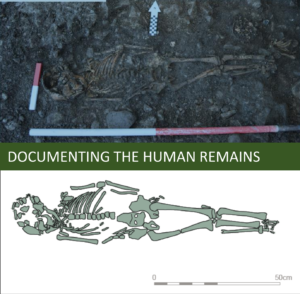
In the vicinity of the Parish Church, recognised as one of the oldest parts of Kendal, during excavation, a number of human remains were found underneath the church boundary wall. These human remains were carefully recovered, documented and analysed which has subsequently told us a great deal about their lives as once inhabitants of Kendal. The Parish Church was first recorded in 1232AD however, historians have argued that an earlier church may have been present on this site before the Norman conquest (1066). The human remains found have subsequently been dated to the 11th century AD proving the argument that a church or religious settlement was present on this site prior to the building of the Parish Church.
At least 66 individuals were identified in the vicinity of the church boundary wall, which through detailed analysis has suggested that they were probably poor laypeople. The injuries and diseases noted during analysis indicated they led hard lives, and lives of toil. The radiocarbon dating of these human remains as medieval is certainly significant as it reveals earlier burial practices being undertaken at the church.
Ancient DNA results are forthcoming as part of a significant national mapping genome project. These human remains will form an important part of this research as data from the northwest, especially Cumbria, is fairly sparse.
A number of significant archaeological features have been exposed and recorded as a result of the Kendal Flood
Risk Management Scheme. These archaeological results have led to a much better understanding of:
Avoidance of Heritage Assets
Wherever possible designs have sought to avoid, protect, and retain Kendal’s heritage assets.
To minimise impacts on Kendal’s bridges, the flood defence walls are being constructed up against them, rather than cutting into the stone.
Preservation of Structures
At Holy Trinity Church, the historic gateway in the boundary wall has been incorporated into the design, leaving it open with landscaping of the area to meet flood defence levels.
The Washing Steps at Waterside have been carefully dismantled. Archaeologists have prepared a detailed record, with individual elements being numbered and securely stored for accurate reconstruction.
Supervision of Work
Where work is required on or near to historic structures, an archaeological and heritage specialists will monitor the work taking place, record finds, and ensure any items temporarily removed are accurately restored.
Archaeological finds
A number of archaeological finds have been made in the vicinity of Waterside. These finds have given us a glimpse into Kendal’s industrial past where wool, cloth and the dying industry were plentiful along the riverside.
Webster railings
There is an exception to the railing design where a section of ‘Webster’ design railings (shown in draft below) will be installed. A section of these will be reproduced on the left bank and this design will influence the railing design throughout the wider scheme.

Visualisation of ‘Webster’ railings
Jennings Yard fountain
The historic fountain currently located at Jennings Yard adjacent to Jennings Footbridge will be relocated to an alternative riverside location.
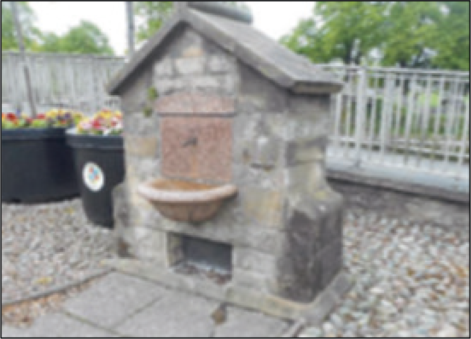
Jennings Yard Fountain
It is important that the Kendal Flood Risk Management scheme is inclusive and that the principles of inclusive design are considered throughout the scheme design process, during construction and during operation.
The design teams have worked carefully to ensure that the needs of people are considered and that the principles of The Equalities Act 2010 are followed. Examples include:
Together with Westmorland and Furness Council, we are identifying locations where we can create, improve or connect into footpaths and cycleways as part of the scheme.

Integration of recreational features, signage, seating and artworks forms a key part of the Kendal Flood Risk Management Scheme.
The proposals are contained within the Kendal FRMS Public Art and Interpretation (Design) Strategy, also termed PAI(D)S. The document provides the rationale for the detailed proposals relating to public art, design of walls and railings, landscaping, floodgates and integration with the historic environment.
Artworks commissioned
Mintsfeet
A place to relax on the banks of the River Kent.
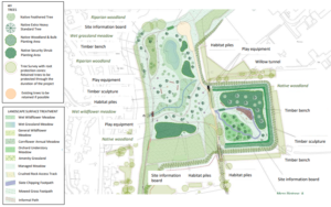
New flood embankments around the boundary of the site provide increased flood protection to homes and businesses in the Mintsfeet and North Kendal area.
New pathways improve access to new wetland habitats, woodland and species rich grassland areas.
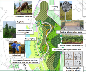
Educational and art installations feature within the area providing opportunities for educational discovery and play.
For those who love to forage, opportunities will be present in the native woodland area.
Beezon Fields
Following consultation with Primary and Nursery schools, a concept of a ‘Sensory Path’ was explored and has subsequently since been delivered. This sensory experience includes features that ‘awaken your senses’ to nature. Other elements of this amenity area include:
When complete, the Kendal Flood Risk Management Scheme will deliver a series of catchment wide flood risk, community, environment and economic benefits.
In Kendal the Environment Agency (EA) are creating better public access, enhancing the environment through landscaping and planting habitat rich species, and preserving and replicating areas of local heritage importance. The EA will also integrate art, seating, sculptures and educational play in key areas throughout the town.
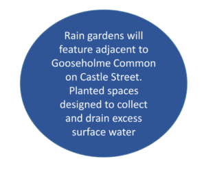
The landscape plans for each area of the town are tailored to the character and conditions of the site with moisture-loving plants in the wetter areas, native species used where possible, but with some more formal planting and ornamental species in the town centre.
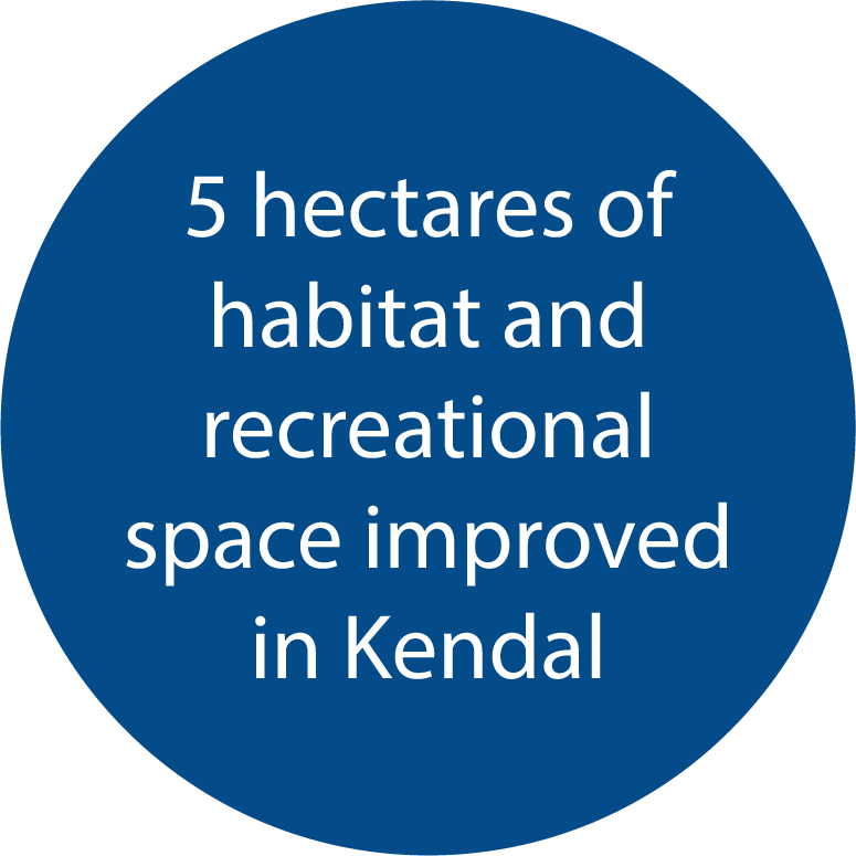
Habitats will be improved outside of the town, with 50 hectares of peatland restoration planned in the upper catchment. This will not only provide ecological benefits, but will help improve water quality, store carbon, and help the catchment become more resilient to the changing climate. In key locations within Kendal, such as Mintsfeet and Beezon Fields, new diverse woodland planting will provide additional cover for otters, and foraging opportunities for birds and bats.
A range of different native woodland types will be planted to provide a range of habitats, from open woodland consisting of mainly taller tree species like oak, birch and alder; to more dense woodland which includes understory shrubs and smaller trees like holly and blackthorn. The planting and landscaping plans have been designed to improve the environment for some of the most threatened and well loved species, such as declining native trees species like aspen.
Specific nest boxes for starlings and swifts will help encourage them back into the area.
New wetland habitats with a diverse range of native marginal planting and seeding will increase biodiversity of both plants and animal species in the area.
Native wildflowers will also provide a boost to pollinators. Insect hotels will assist with providing richer habitat opportunities for insects and invertebrates.

A range of various size trees will be planted throughout Kendal. The table below shows the type, location and planted heights
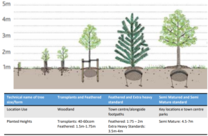

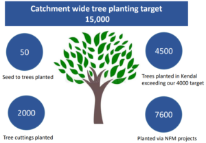
4,500 new trees will be planted to create a habitat rich river corridor. Unfortunately, some trees will need to be removed to allow works to take place, and the amount of trees currently identified for removal is below 500.
Different sized trees will be planted in order to serve different functions and to best suit certain locations.
For example, native species will be planted in more rural locations where habitat creation is important, and in the town centre locations, ornamental trees that are suitable for urban planting have been selected to suit the character of the town.
Below are some of the native trees and seed mixes that will be planted in more rural locations on the edges of Kendal e.g Mintsfeet, Beezon Fields and Helsington Mills. These species will compliment the natural setting and provide food and shelter for wildlife.
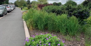
Below are some of the ornamental and native trees, shrubs, grasses, perennial and bulb species that will be planted in town centre locations, including streets, parks and open spaces, e.g. Abbott Hall, Gooseholme Park and Aynam Road. Species will be selected that are appropriate in size and will provide seasonal interest and wildlife value, such as supporting pollinating insects and birds.
During construction local firms and specialists have been employed and materials have been sourced locally wherever possible. The stone facing used throughout Kendal is supplied by Orton Quarry, Slate is supplied by Burlington Quarry and the path surfacing is supplied by Kendal Quarry.
So far during construction over 60% of the current construction outlay has been invested into the Kendal local economy.
Through managing flood risk in Kendal and reducing flood damage costs, the scheme will also help to provide security and stability to the local economy.
Carbon Reduction


The Environment Agency has set a 45% carbon reduction target for its capital schemes by 2030.
The Environment Agency’s initial estimate of scheme carbon emissions was identified within their business case. This is termed the “carbon baseline”.
The EA are working to reduce their carbon emissions through:
Carbon use and reduction will be monitored throughout the scheme.
Carbon Offsetting
Additional carbon will be offset through the creation of new environmental areas, upland peat restoration and Natural Flood Management (NFM) schemes including tree planting.
Click here to return to Kendal Flood Risk Management Scheme page