Preparing for Construction
Ahead of any construction, preparation works have to be carried out and this will involve moving services such as cabling or strengthening sewers. Until work on services is complete, constructing the flood defences cannot start. You can expect to see a number of service providers in flood scheme areas including, United Utilities, Electricity North West, and BT.
Some of the major relocation and service diversion works may require footpath closures / diversions and temporary lane closures on the highway. In addition, some of the working areas will need to be free from street furniture such as seating, bins, and street lighting. All street furniture will be restored on completion of the works.
Working Hours
The working hours approved through planning permission are 8am to 6pm Monday to Friday and 9am – 2pm on Saturdays. The Environment Agency and its construction partner VolkerStevin do not expect to work on weekends or public holidays.
Utility and service providers may have agreed different working times with the Council.
Minimising Construction Noise and Dust
Unfortunately, some noise and dust will be created by the construction. However, we will monitor and manage noise, vibration, and dust levels and we will work to reduce any impact on homes, businesses, public areas, and the natural environment wherever possible.
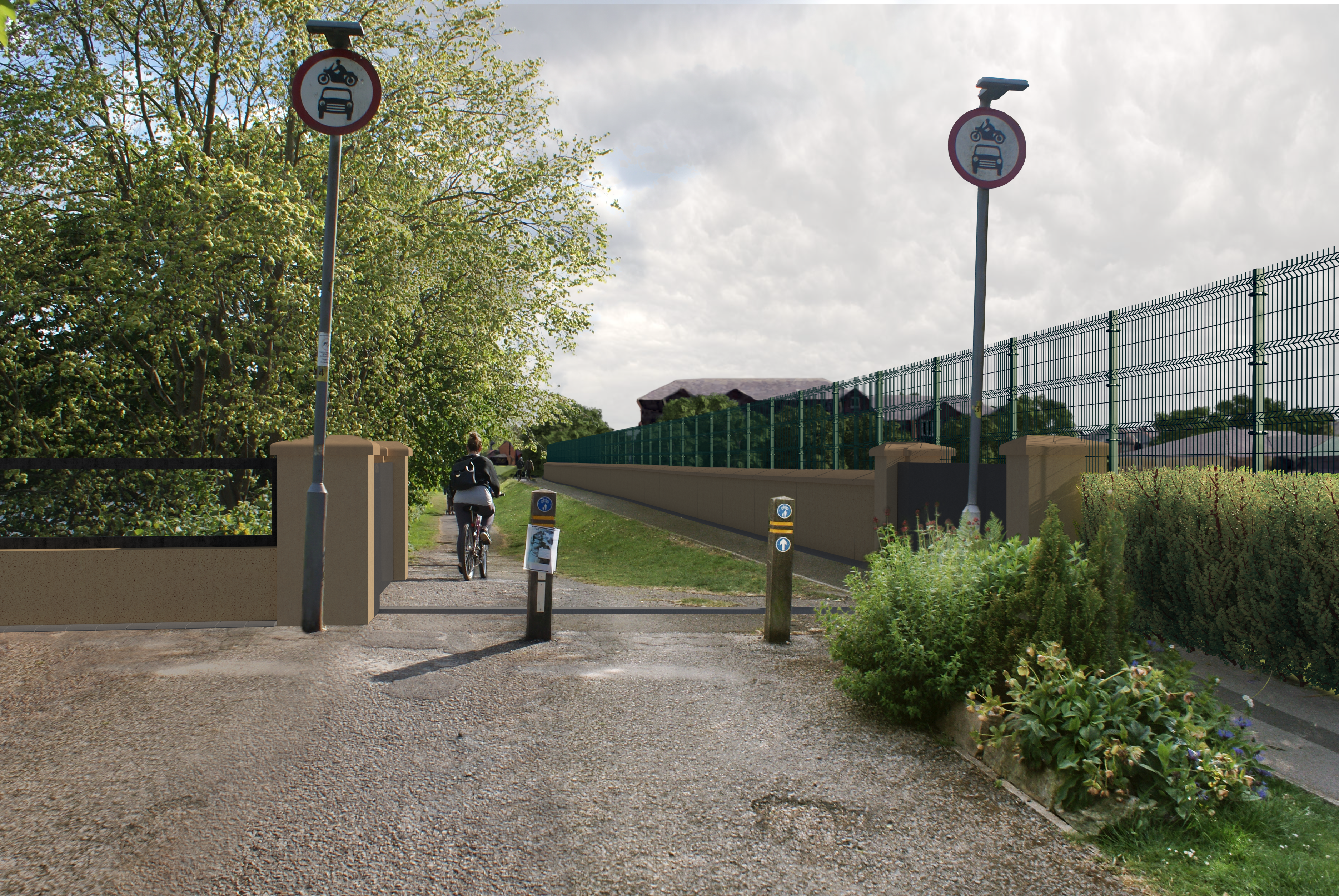
Several monitoring techniques will be used and there will be a range of measures to provide visual screening, which will assist with reducing noise and dust levels.
To manage any debris on the roads, created by construction traffic, cleaning of the carriageway will be undertaken by a road sweeper or similar, as appropriate.
Construction Traffic
The working areas will be compact, balancing the need to keep contractors and the community safe while minimising disruption. In some areas there will be dedicated routes for bringing in materials and plant to the site compound area and then distributing from the site compound to the various work areas.
Diversions and closures will include:
- At Margaret Road, Lower Penwortham, a one-way system will be in place for construction traffic to minimise the impact on residents.
- Riverside and Riverside Road will be closed during works.
- Along Broadgate, works will be carried out in 200m sections with temporary traffic light controls. Some footpaths and parts of the Guild Wheel will be temporarily closed.
The Traffic Management Plan has been developed with Lancashire County Council Highways, who will ensure any temporary road or lane closures are managed appropriately to minimise traffic disruption.
Click here to return to the PSR Flood Risk Management Scheme Homepage