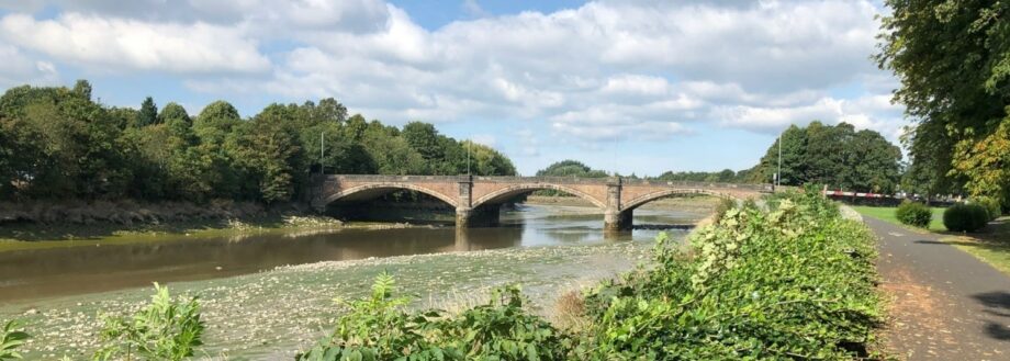
The Environment Agency is delivering a Flood Risk Management Scheme to better protect homes, schools, and businesses along sections of the River Ribble and River Darwen. The Scheme will also deliver improvements to the local environment and community amenities.
For a complete overview of the Flood Risk Management Scheme, click the link below to download a copy of the Design and Benefits Guide. It explains how the scheme will be delivered, what will be constructed, the benefits of the scheme, and what the community can expect during construction.
Please note this document is currently under review and will be updated early 2025. For the latest information, please contact the team here.
Preston and South Ribble Flood Risk Management Scheme – Design and Benefits Guide
Click here to return to the PSR Flood Risk Management Scheme Homepage

The design of the Flood Risk Management Scheme will be sympathetic to the local area. All the flood walls will be built and finished in a way that is appropriate for the existing buildings and landscape.
The flood defences will feature a mix of raised embankments, walls (with glass panels in some areas), and floodgates.
The finishes for the flood defence walls have been agreed with Lancashire County Council, Preston City Council, and South Ribble Borough Council. The walls will be made predominantly from pre-cast concrete and topped with coping stones.
Glass panels will be used where wall heights exceed 1.4m, and in residential areas where existing properties had an unobstructed view of the river. The panels will allow residents and visitors to the area to continue to enjoy the view.
The panels are an integral part of the flood defences. The glass is ‘self-cleaning’ to provide the best finish. The frames are as thin as possible (typically 4-9cm) with supporting pillars of around 16cm. The frames are part of the defences and strong enough to withstand the forces of flood water. The frames are also powder-coated black to match street furniture and the new flood gates.
Four new flood gates will be installed as part of the scheme. The flood gates are recessed between pillars, so they are out of the way when not required. The gates will remain open during normal times and will be closed by the Environment Agency in the event of weather warnings and the risk of flooding.
A Redi-rock embankment has been built along Broadgate to stabilise the riverbank. Made from pressed concrete with a decorative cobblestone finish, the design features recessed areas in each block for planting. Over time, vegetation will grow, softening the appearance of the blocks.
Additionally, rock armour and rock bags have been used to reinforce the riverbank, which will also become more natural-looking as they are gradually covered with plant growth.
Click here to return to the PSR Flood Risk Management Scheme homepage
Broadgate Gardens has been restored with a mix of fruit trees, ornamental shrubs, and amenity grassland. Additional seating areas have been provided and the Environment Agency has restored the riverside viewing platform.
In Lower Penwortham, the Environment Agency is working with South Ribble Borough Council to create an insect and wildlife-friendly wetland habitat, the design includes:
An area of amenity grassland and the existing children’s playground will be retained for recreation.
The design team has worked carefully to ensure everyone’s needs are considered.
Planting new trees, grasses, wildflowers, perennials, and shrubs to promote mental health and wellbeing.
Click here to return to the PSR Flood Risk Management Scheme Homepage
Tree surveys are conducted before any removal, in consultation with relevant partners, and no trees are felled during the bird nesting season. Whenever possible, trees are incorporated into the scheme’s design to support natural habitats and for other purposes.
The Environment Agency is committed to planting at least 12 trees for every one tree that has to be removed. The scheme is working closely with partners to identify the best planting locations, this includes supporting South Ribble Borough Council’s “Plant 110,000 trees” programme and the planting of over 8,000 trees along the river at Fishwick Bottoms in Preston.
Proposals for replacement and compensatory planting, as well as landscaping and biodiversity requirements, are detailed within the Environmental Masterplans as part of the Planning Application submission.
A range of ecological surveys have been undertaken to inform and support the proposed scheme. The scheme encompasses habitats associated with the urban location along the River Ribble and River Darwen, i.e. grasslands, tree lines, roads, bridges, and pedestrianised areas.
Surveys pay particular attention to the otters living along the River Ribble and to local bat activity.
Work in the river is restricted to between June and January to avoid impacting coarse fish, smelt (small fish), and eels present in the River Ribble.
Habitat creation will take place at Fishwick Bottoms and Ribble Sidings to compensate for tree loss due to the scheme.
Some of the flood defences are next to historic structures such as the Penwortham Old Bridge. Care will be taken when construction is happening in these areas.
If required, any small objects of historical interest, for example mile markers, will be removed while construction is ongoing, and then restored to same location on completion of the flood defences.
Click here to return to the PSR Flood Risk Management Scheme Homepage