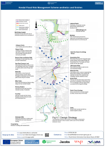
The Environment Agency is delivering a proposed Flood Risk Management Scheme to better protect homes and business from flooding in the Kent catchment, and improve the local environment and community amenities. Kendal is the first area to be delivered, followed by Burneside, Staveley, and Ings, and upstream measures including flood storage. In addition, Natural Flood Management measures are being integrated into the plans which aim to slow the flow of water and provide wider environmental benefits across the catchment.

Construction of the Kendal scheme commenced in February 2021 and will be complete in 2027. The proposed new flood defences extend from Mintsfeet in the North of the town to Helsington Mills in the South.
 6km of defences will run through the town using a combination of walls finished mainly in local stone, grass embankments and integrated sections of glass panels. With more than half of the defences set back from the riverside, integrated floodgates enable access to existing open space, and riverside views will be maintained.
A new improved pumping station is being constructed on Stock Beck. Located at Gooseholme, the new pumping station will pump water from Stock Beck, reducing flood risk from the drainage system.

5 hectares of habitat and recreational space has been improved at two sites located at Beezon Fields and Mintsfeet.
3km of footpath improvements will enable partner projects including cycle ways and footbridges to be developed. Improved connectivity to riverside recreational space will be delivered.

At least 4,500 new trees will be planted to help mitigate for the loss of around 500 trees. This means at least 9 new trees will be planted for every one removed.
Click here to download the scheme location plan.

