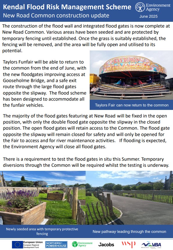
New Road Common Completion – June 2025
Click here to read the Environment Agency’s construction completion update.
New Road Common Construction Update – June 2025
Click here to read the Environment Agency’s construction update.
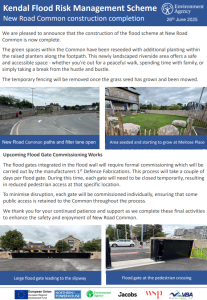
New Road Common Update – June 2025
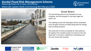
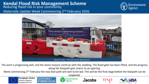
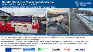
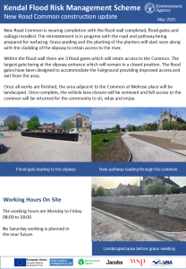
New Road Construction Update – May 2025
Click here to read the construction update.
New Road Construction Update – March 2025
Click here to read the construction update
New Road Construction Update – December 2024
Click here to read the construction update
New Road Sheet Piling – October 2024
Work will be starting in early November to create the foundations for the new flood wall along New Road. Sheet piling is a technique used that drives long steel interlocking sheets into the ground, this method not only reduces groundwater flows but also creates a solid base to build the flood walls from. Find out more about this method here:
Construction Update – October 2024
Click here to read the construction update.
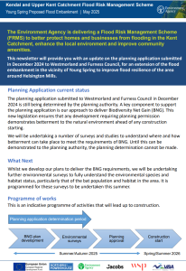
Planning Application Update October 2024
New Road Common planning application has been approved. Find out more about the works in this video.
Preparing for construction September 2024
Click here to read the update – September 2024
Environment Agency Press Release – New Road Planning Approval September 2024
Following the Westmorland and Furness planning committee meeting on 12th September an approval decision has been made. Find out more below for what steps the Environment Agency will take to ‘prepare to start construction/review our options’. – September 2024
Planning application for flood defence works at Kendal’s New Road
Planning permission has been granted for a revised design for flood defences at New Road in Kendal by Westmorland and Furness Planning Authority following the planning committee deferring the application in May.
Feedback from local residents and interest groups on the original plans approved in 2019 as well as comments through the common land consultation shaped further improvements made to the flood scheme design by the Environment Agency.
The new design includes changes to the open aspect and accessibility through the area for both the local community and visitors. The approved design includes a safer Common access arrangement for the fairground and for other activities at the location.
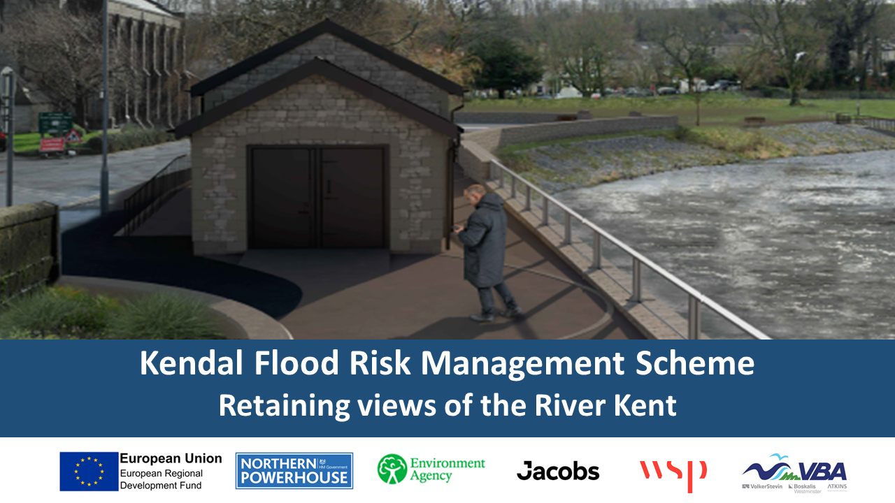
The New Road flood wall complements the stonework and finish of Gooseholme Bridge and the wider flood scheme throughout Kendal, creating and maintaining a safe community green space with access for all.
The planning decision means work can now start on this section of the Kendal and Upper Kent Catchment Flood Risk Management Scheme which will better protect more than 1,920 homes and 2,250 local businesses from the impact of flooding.
Environment Agency Flood and Coastal Risk Manager, Richard Knight said:
“These changes to the original design have been made in response to the feedback from the community and interested parties. We listened, we duly considered local people’s requests, and we believe the new design will enhance the town whilst providing better protection to homes and businesses against the very real threat of flooding.
“Being granted planning permission for the New Road area heralds the start of the next part of the flood risk management scheme for Kendal.
“It is important to get the scheme built as quickly as possible to protect the homes and businesses in this area of Kendal.”
For more information about the Kendal flood scheme, visit the Information Hub at 2 Beezon Road adjacent to Lidl which is open to the public Tuesdays and Thursdays, 10.00 am to 4.00 pm.
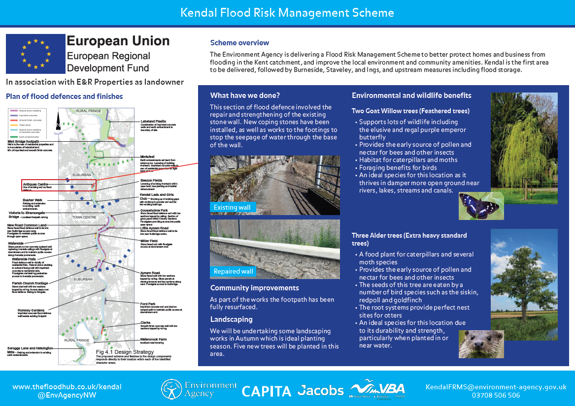
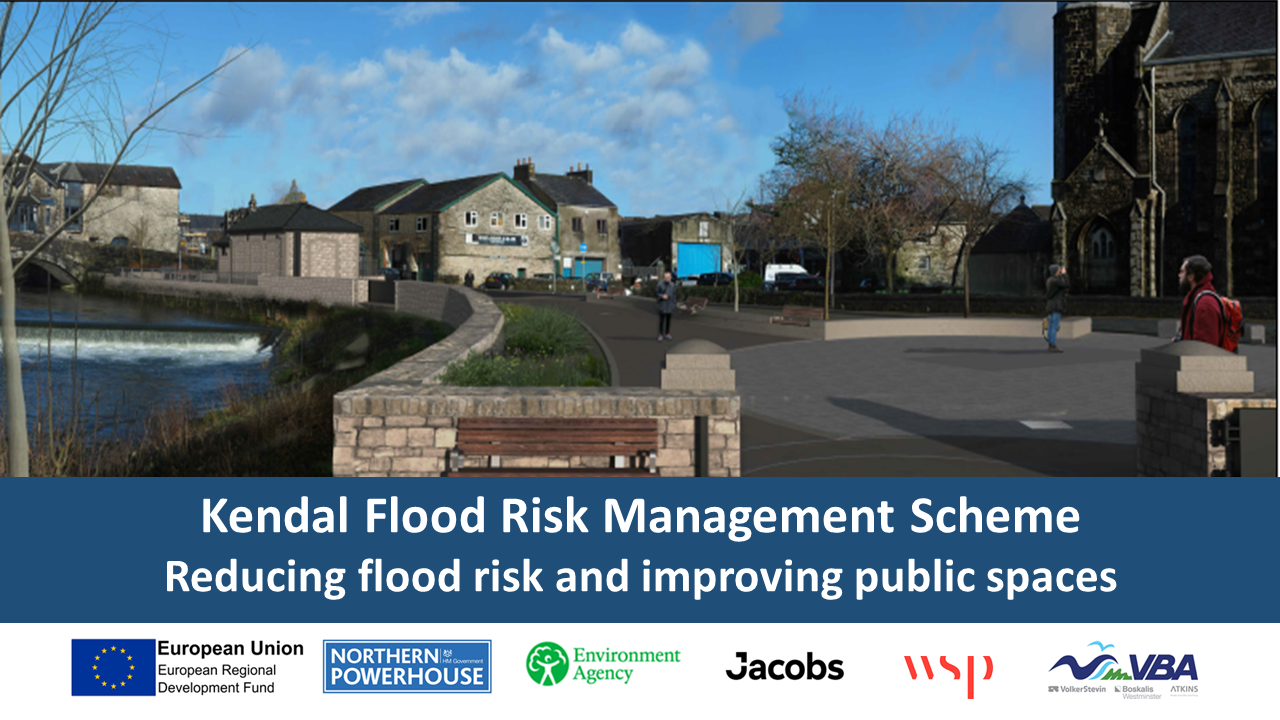
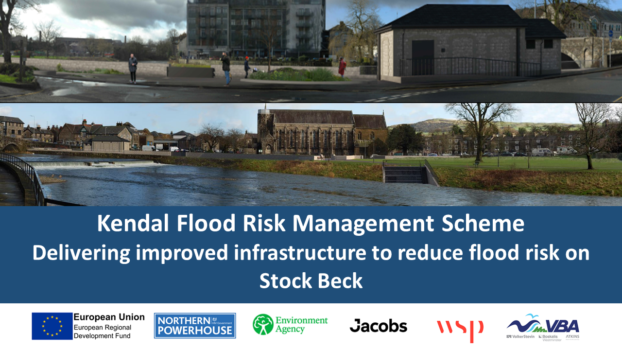
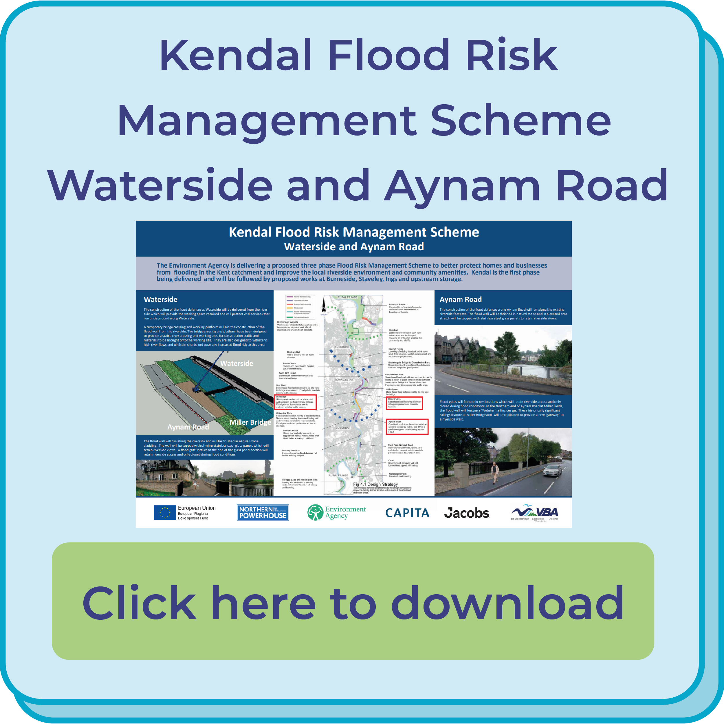
New Road Common
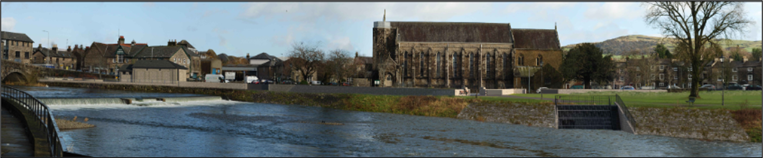
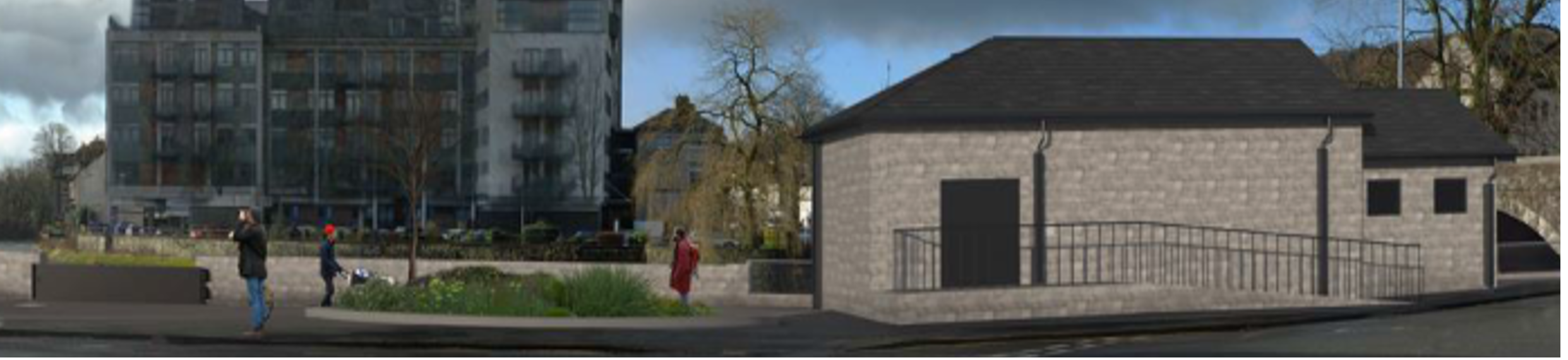
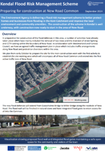
Following the original planning approval in 2019 and subsequent feedback from the community and local interest groups, the Environment Agency have further improved the flood scheme design for New Road. The improved design will predominately reduce the height of the flood wall along New Road Common, improve the open aspect and accessibility through the area for both the local community and visitors to the town, and includes a safer Common access arrangement for the Fairground and for other operational activities.
The proposed flood wall complements the stonework and finish of Gooseholme Bridge and the wider flood scheme throughout Kendal, creating and maintaining a safe community green space with access for all.
The below visualisations show the proposed flood scheme from a Southerly and Northerly viewpoint of New Road Common:

Click here to view the existing view and full visualisation

Click here to view the proposed view and full visualisation

Click here to view the existing view and full visualisation

Click here to view the proposed view and full visualisation
A summary of the Scheme design is here
These improvements have been submitted to Westmorland and Furness Planning Authority as a planning application which is currently being determined. You can visit the planning portal to access further information here Planning application: 2024/0216/FPA | Westmorland & Furness Council (westmorlandandfurness.gov.uk).