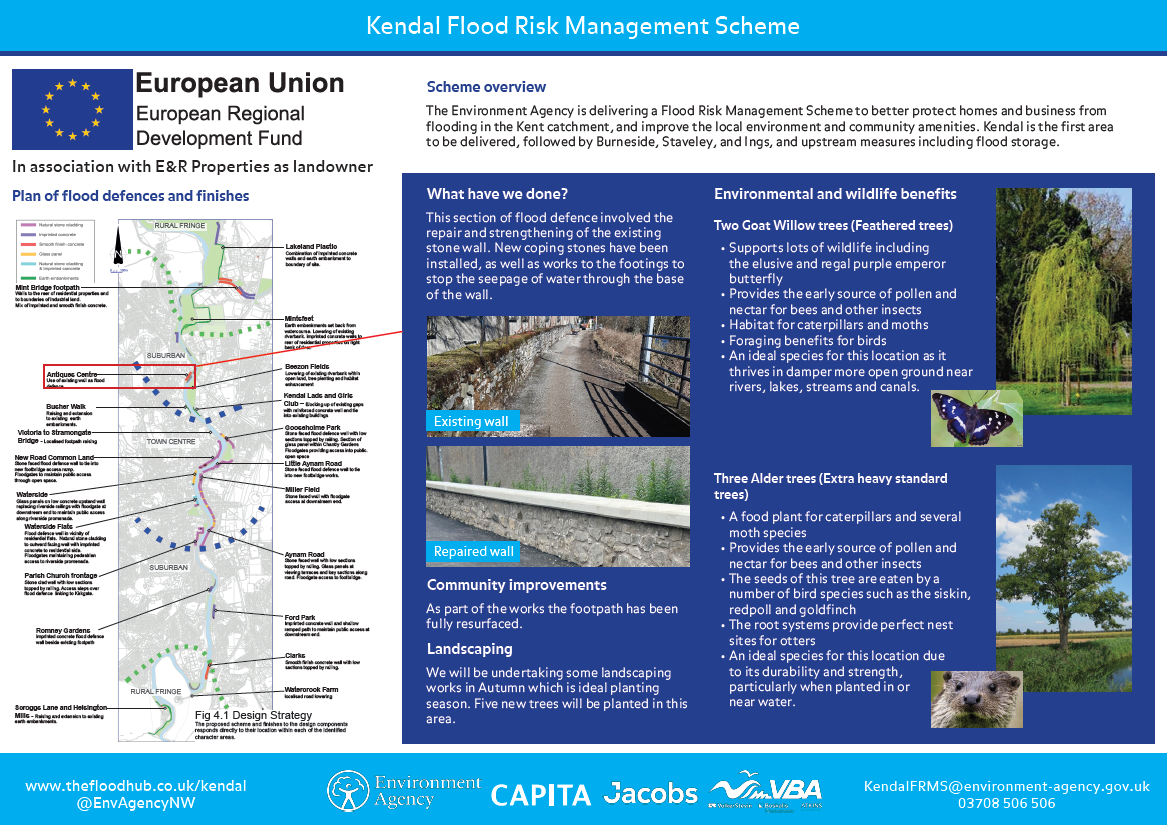
The Environment Agency is delivering a proposed Flood Risk Management Scheme to better protect homes and business from flooding in the Kent catchment, and improve the local environment and community amenities. Kendal is the first area to be delivered, followed by Burneside, Staveley, and Ings, and upstream measures including flood storage. In addition, Natural Flood Management measures are being integrated into the plans which aim to slow the flow of water and provide wider environmental benefits across the catchment.


Click here to return to Kendal Flood Risk Management Scheme page
A Community Flood Hub is open on Beezon Road, Kendal to provide people with the opportunity to find out more about the multi-million-pound investment to better protect the town from flooding. The building adjacent to Lidl supermarket will be open Tuesdays and Thursdays between 10am and 4:30pm and will provide information on the Kendal Flood Risk Management Scheme.
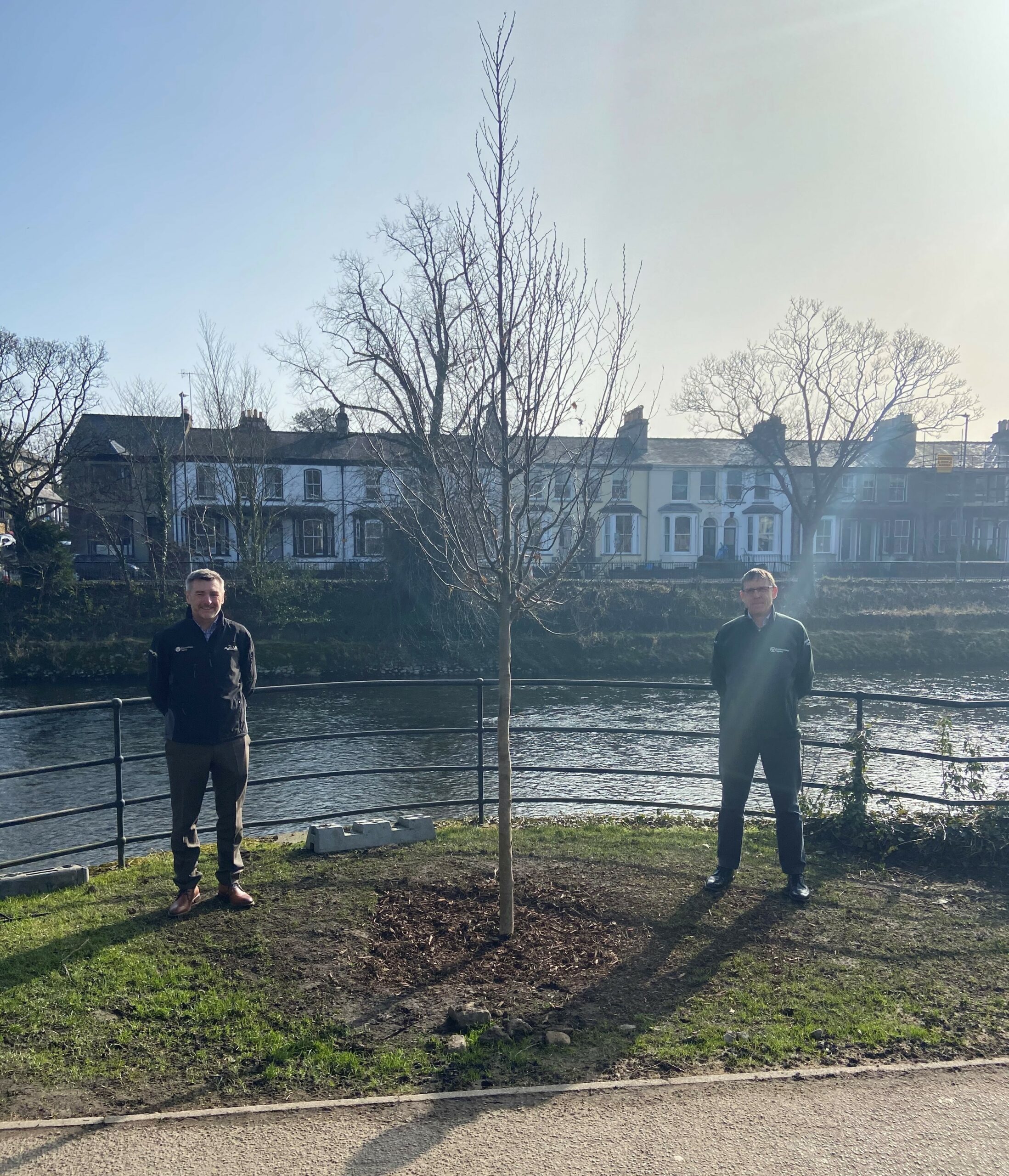
Environment Agency and VBA staff at tree planting site
There are a number of opportunities to get involved in the scheme and the Environment Agency will be delivering some of these directly with local schools, community groups and charities. Keep an eye on this events section for events that will be happening near you.

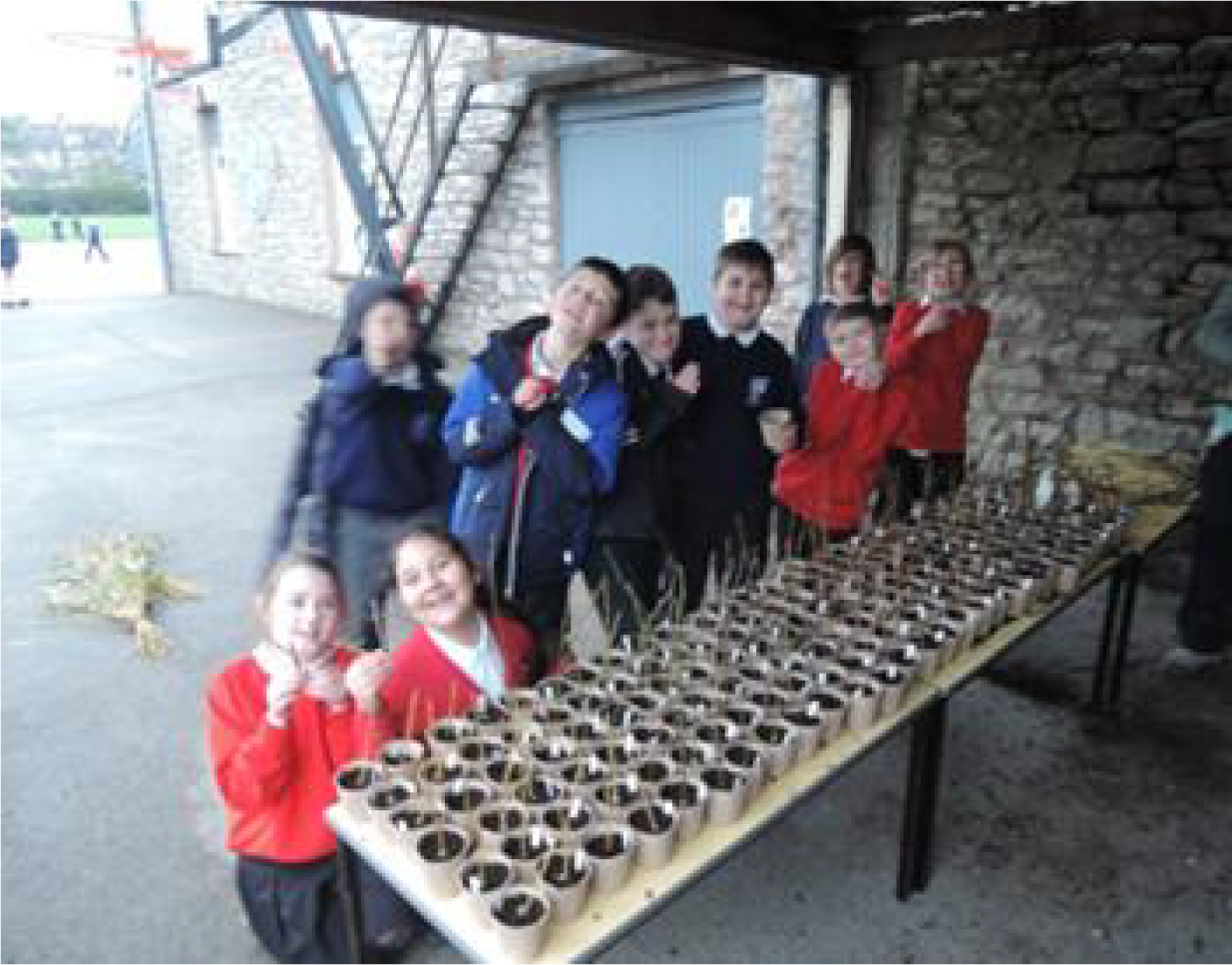
Some of the 1,000 tree cuttings planted by St Thomas’ and Stramongate Schools
The Kendal and Upper Kent Catchment Project Team have recently launched their ONE MILLION MINUTES!
This initiative provides an exciting opportunity to give back to the local area, through acts of kindness that benefits the local community and environment.
By joining forces, the team will aim to give back the equivalent of ONE MILLION MINUTES by pledging their time to undertake community, environment, education and/or fundraising based activities.
Already this year, they have delivered over 5000 minutes of kindness.
The Environment Agency is featuring the work of a Kendal based artist Bob Henfrey, who has captured the construction of the Kendal Flood Scheme in watercolours. The virtual walking art gallery which is part of an online map guide is now available and gives residents and visitors a unique opportunity to see this substantial Government funded civil engineering project being captured through sketches and paintings.
The Kendal Flood Scheme Virtual Art Gallery is an online map, which can be viewed by clicking here, links Bob’s watercolours with the locations along the River Kent in Kendal where work has been completed and is currently taking place.
Artist Robert, who has lived and worked in the town since 1993 has created over a dozen sketches of the ongoing civil engineering project. His art has depicted the progression of the project from various points of view, and he is creating a series of sketches which will record the event as a personal project.
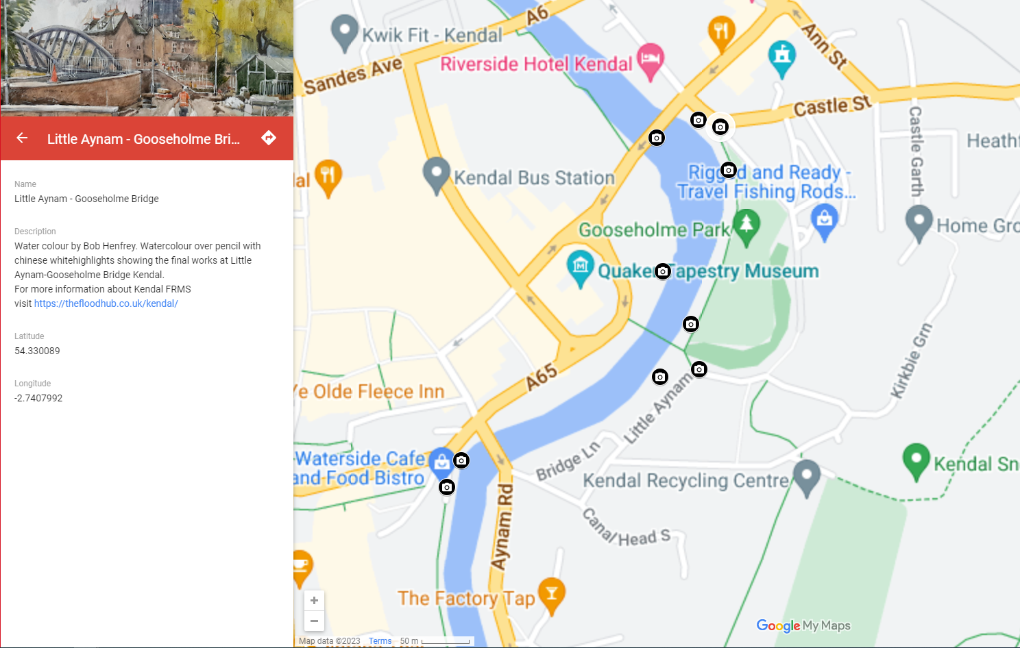
Screenshot of virtual walking art gallery which is part of an online map guide for the Kendal Scheme (click the above image to load the map)
To read more about the Kent Catchment Partnership, click here to visit the Upper Kent ‘Across the Kent Catchment’ section.
The Environment Agency has started works to construct a Flood Wall along the riverside boundary of Dale Farm Creamery located adjacent to the River Mint, downstream of Mint Bridge. The flood wall will be approximately 106m long which will tie into high ground at either end and finished primarily in imprinted concrete. It is anticipated that the construction of the new flood defence will be complete in November 2024.
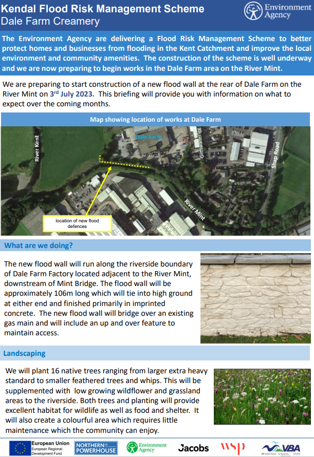
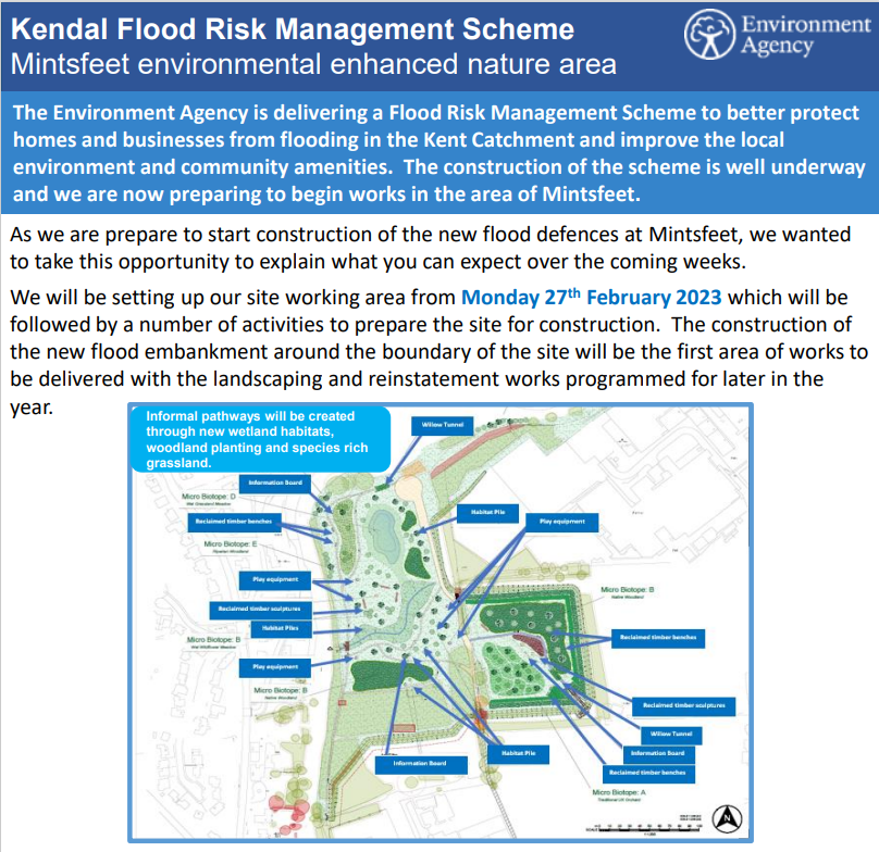
The aim of the Kendal Flood Risk Management Scheme is to not only protect people and properties from flooding, but to create a lasting benefit for the community and the local environment. The Environment Agency plan to improve this well used area within the northern extent of the town through targeted landscaping and planting that will enable the bringing together of enhanced habitat for wildlife and better community access and usability.
Click here to download the document above
Press release from the Environment Agency 21/07/2021
Today the multi-million pound Kendal Flood Risk Management Scheme reached a new milestone with the completion of works at Dockray Hall including structural repairs, community improvements and future benefits to the environment and wildlife.
Representatives from the Environment Agency, Westmorland and Furness Council (formerly Cumbria County Council and South Lakeland District Council) and elected members marked the occasion with a visit to the site located along the riverside at Dockray Hall.
When complete the overall flood scheme will reduce the risk of flooding to 1,480 homes and 1,100 local businesses across the River Kent catchment.
Stewart Mounsey, Flood Risk Manager for Cumbria said;
“We’re really pleased with how the Kendal works are progressing and this latest development brings us one step closer to protecting the local community and businesses from flooding.
“In planning the works at Dockray Hall, we wanted to make sure that not only structural improvements were made, but to make sure we incorporated features that would further enhance the area with a fully resurfaced footpath and new trees planted boosting the biodiversity of the area.
“Our contractors will return to Dockray Hall in the autumn to make sure five new trees are planted at the ideal time for maximum growth.”

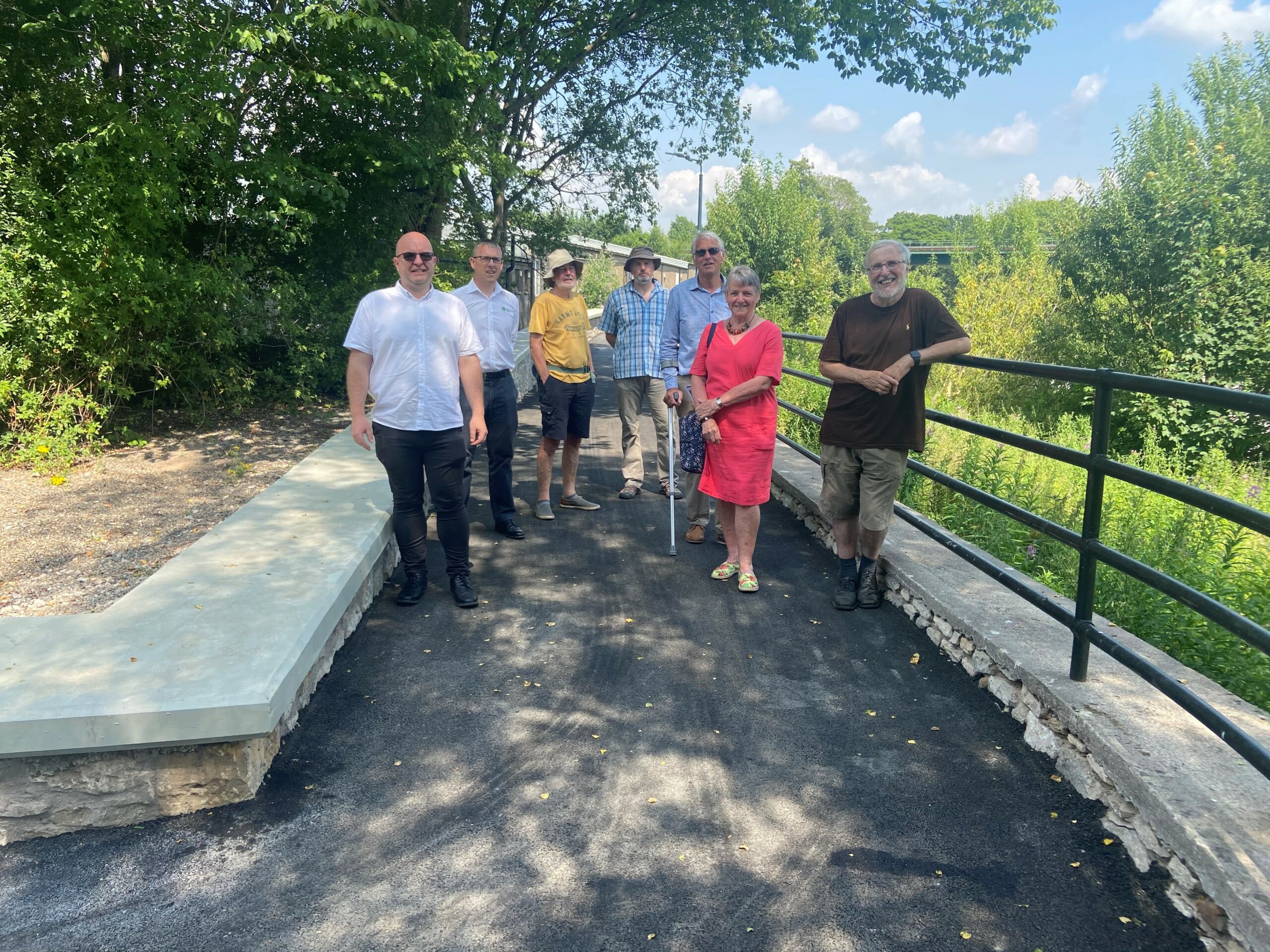
Official launch of Dockray Hall completion with a tour of the works by Stewart Mounsey, Environment Agency and Ian Bolt, VBA with local elected members
The aim of the Kendal Flood Risk Management Scheme is to not only protect people and properties from flooding, but to create a lasting benefit for the community and the local environment. The Environment Agency plan to enhance this area alongside the river through extensive landscaping, planting, and integrating a number of art and educational features.
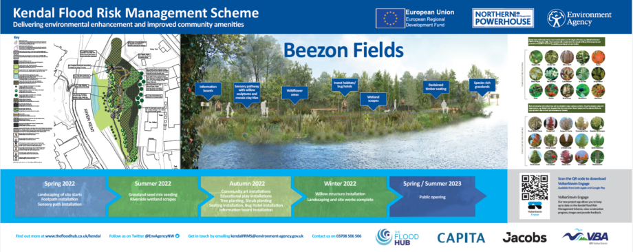
Stone seats have been hand carved from repurposed limestone which once formed part of the original Gooseholme Footbridge. These stone seats will comprise of the original footings and coping stones of Gooseholme Footbridge and will feature along the riverside on Beezon Fields.
At Benson Green, the new flood defences comprise of five in situ cast reinforced concrete walls, clad on both sides in locally sourced natural stone to compliment the existing aesthetics. At Busher Walk, the existing embankment was removed and a new flood embankment has been constructed. This is the sixth reach to be completed in Kendal.
Press release from the Environment Agency 12/01/2022
January sees the start of construction of two new sections of the Kendal Flood Risk Management Scheme.
The Environment Agency and contractors, Volker Stevin, will begin work at Busher Walk and Benson Green in Kendal with construction works taking around four months to complete.
At Busher Walk, 110m of flood embankment will be built to improve the flood protection to local homes and businesses. At Benson Green, the replacement and construction of new flood walls will provide the community with improved flood protection. When works are complete the existing access ramp to the riverside footpath will also be reinstated.
All flood defence walls in this area will be clad on both sides in local stone to compliment the local aesthetics.
To allow the works to be carried out safely, the riverside footpath will be closed between Dockray Hall and Victoria Bridge and there will be a diversion in place.
Keith Roddy, Programme Manager for the Kendal Flood Risk Management Scheme said:
“Our thanks once again go out to residents and businesses for their patience whilst we carry out works at Busher Walk and Benson Green to better protect more homes and business from flooding.
“The Environment Agency and contractors Volker Stevin were able to complete four sections of the scheme in 2021, and this momentum continues into 2022.
“The scheme in Kendal is an important part of how the Environment Agency is working locally to help communities adapt to the increasing flood risk caused by the climate emergency.
“We cannot protect against every flood, however the £76million scheme in Kendal will significantly reduce the risk of flooding to 1,400 homes and 1,100 business.
“It’s also vital everyone knows the threat to them and how to keep their loved ones, property and possession safe.
“Go to the Gov.uk website or search ‘know my flood risk’ to sign up for flood warnings, receive information on the risk in your area and what to do in a flood: https://check-for-flooding.service.gov.uk”
Construction of a new flood wall has commenced at Melrose Place. The 15m flood wall will extend from Melrose Place along the riverside to Gooseholme Bridge and is expected to be complete in March 2024. The works have included the installation of scaffolding along the riverside which will aid the removal of the existing riverside wall, and the rebuilding and cladding of the new flood wall. During construction, public access will be maintained to Gooseholme Bridge and within New Road Common.
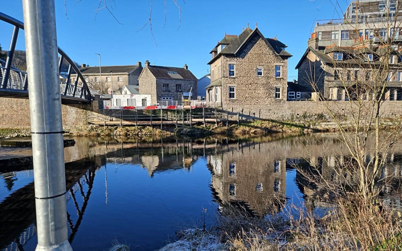
Flood defence works at Sand Aire House and Lambrigg Terrace is the ninth section of work to be completed in Kendal. The construction works at Sand Aire House and Lambrigg Terrace consist of a new riverside flood wall finished in natural stone. At Sand Aire House, replacement and additional planting has taken place, a new riverside access has been integrated with up-and-over steps to the north of the car park and riverside views have been maintained by the addition of a raised decked area to the south.
Construction of the new flood wall along the riverside at Sand Aire House, Lambrigg Terrace and Melrose Place has now started. This new 200m long stone clad flood wall extends from The Bridge Inn to the new Gooseholme Footbridge and will better protect homes and businesses in this area. Further information can be found in this newsletter.
Click here to read the update – 9th February
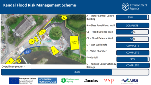
Click here to read the update – 9th February
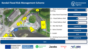
Click here to read the update – 2nd February
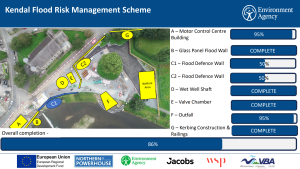
Click here to read the update – 26th January
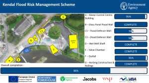
Click here to read the update – 19th January
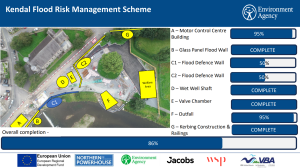
A milestone moment has been celebrated as the first glass panels have been installed as part of the flood risk management scheme at Castle Street, adjacent to Gooseholme Common. This is the first section of three locations which will benefit from glass panels which will better protect homes and businesses and retain scenic riverside views.
The flood walls are finished in natural stone from a local quarry with the panels made of high-performance glass within a high specification stainless steel frame. The glass benefits from a self-cleaning technology and are designed with slimline frames to maximise the glass viewing areas whilst maintaining the strength. The glass used as part of the innovative flood wall design, is a bespoke creation developed in partnership with Pilkington United Kingdom Limited, part of the NSG Group, and chemical and materials manufacturer Kuraray.
Click the link to see the unveiling of the glass panels https://www.facebook.com/share/v/bohcxbmQAVRwgdAm/?mibextid=WC7FNe
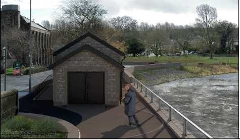
Visualisation showing the glass panels leading to Gooseholme Common and new planting beds which will incorporate riverside seating
Work started in Summer 2022 to repair a section of the riverbank adjacent to Stramongate Bridge on Castle Street. The damage to the riverbank in this location was far greater than expected which has required a pause in works and a re-design. As the repair works require in-river working, the Environment Agency have stopped works and made the area safe over the Winter period. The repair works will restart in this location in Summer 2023 followed by the construction of the flood wall.
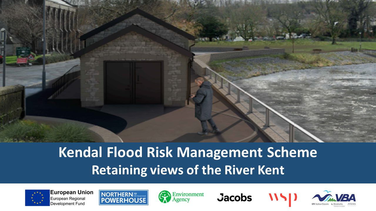
Click here to view a larger version of the visualisation
As part of the Kendal and Upper Kent Catchment Flood Risk Management Scheme we want to address the flood risks associated with Stock Beck, and design improvements which will manage water within the catchment more effectively. A combination of measures will be used to improve the conveyance of Stock Beck through the town, as well as managing excess flows to reduce the risk of flooding to include:
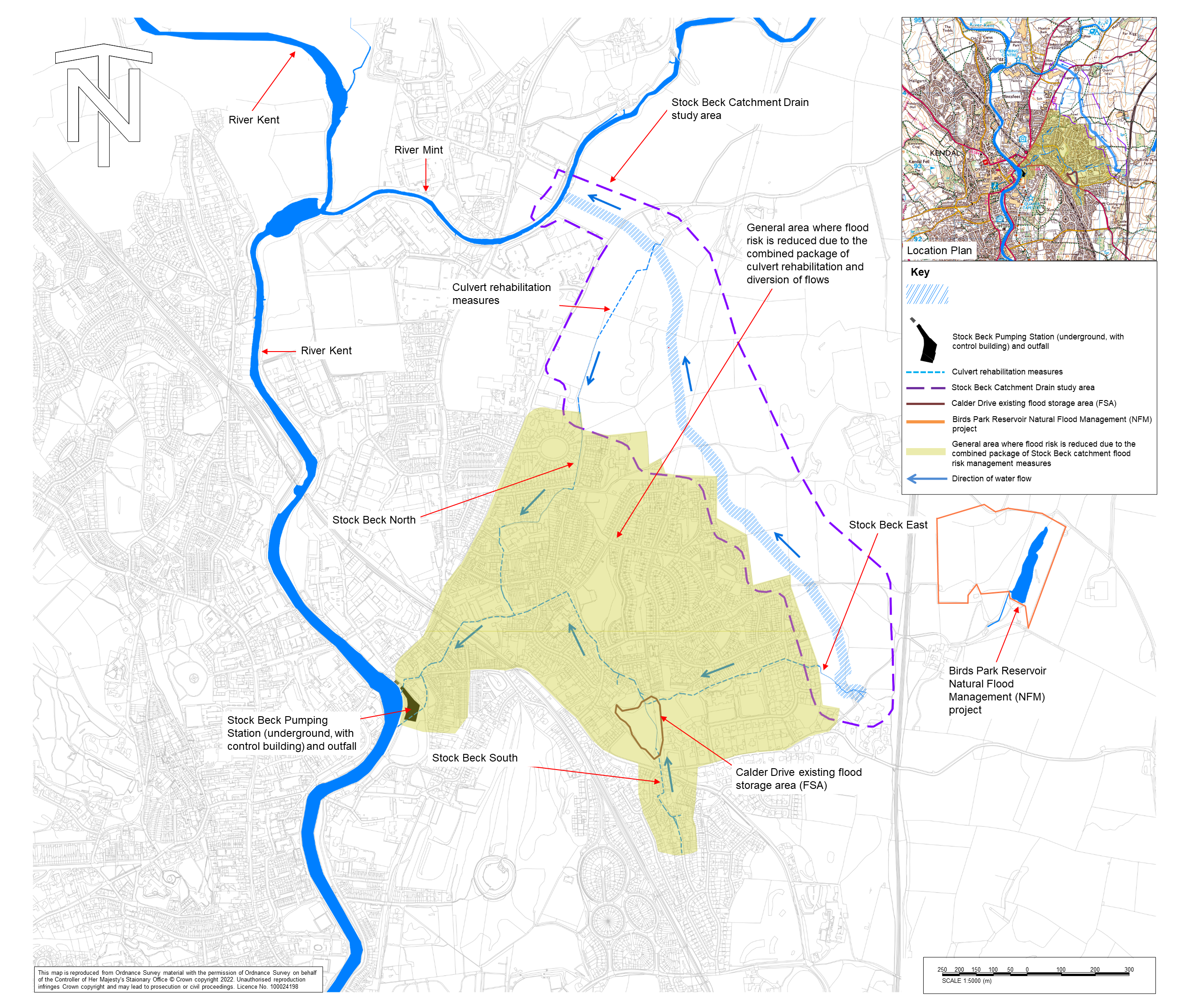
The role of a catchment drain is to limit the amount of water that flows into a main river during high rainfall, reducing flood risk to homes and businesses. It achieves this by diverting flows into a different, larger, main river before the levels in both rivers reach their peak.
In the Kendal and Upper Kent Catchment Flood Risk Management Scheme, the catchment drain is designed to carry surface water, intercept some of the groundwater from the upper reaches of Stock Beck East and Stock Beck North and divert flows into the River Mint. This will reduce the risk of flooding in Kendal urban area and the residential area of Sandylands, Kendal.
The Environment Agency is currently working with Westmorland and Furness Council (WmFC) to prepare the planning application for Stock Beck Catchment Drain. As part of this process, we are seeking pre-application advice; a valuable step in the planning process that occurs before submitting a formal application. This will help to ensure we submit an application that meets all WmFC’s planning requirements.
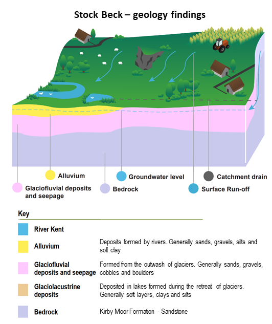
Ground investigation surveys identified superficial deposits overlying the Stock Beck study area that are predominantly composed of sand, gravel, cobbles, and boulders. These are highly permeable and need to be considered in the design of the flood risk management scheme. In discussion with landowners, the design has been updated to a piped solution into the River Mint.
Find out more
Rehabilitation works will commence this summer to improve the structural integrity of the culvert system which will improve the conveyance of water on Stock Beck.
Stock Beck comprises of several sections of watercourse that originate in farmland before entering the eastern side of Kendal. The watercourses converge and are joined by inflows from surface water drains. The combined flows pass through largely culverted sections within the urban area and outfall into the River Kent in the town centre, near Gooseholme Park. These works, together with construction of a new pumping station at Gooseholme, and the proposed catchment drain to the Northeast of Kendal will improve conveyance and reduce flood risk.
The Environment Agency carried out a number of ground investigations during 2021 and culvert surveys during 2022 to determine the ground conditions and underground features as well as the existing structural integrity and conveyance capacity of Stock Beck culvert running through the areas of North East Kendal. The data and information from these investigations and surveys have identified where repairs and restoration works will be required, and has informed a detailed design for the required culvert improvements which will start to be delivered this summer.
Whilst the majority of work will be undertaken in the highway, we will require temporary access to some residents’ gardens and/or driveways. Those affected will be notified prior to the work, and traffic management put in place where required. Any inconvenience caused will be kept to a minimum.
YouTube videos showing CIPP lining projects completed by our specialist contractor ‘OnSite’ can be found by clicking here or typing this link into your browser: https://onsite.co.uk/capability/cipp-relining/
Following extensive surveys and investigations into the structural integrity of the Stock Beck culvert system, a section of culvert has been identified for replacement in the area of Silverdale Drive. This newsletter will provide an overview of the culvert replacement works which are scheduled to start from 23rd June 2025. Click here to download the update.
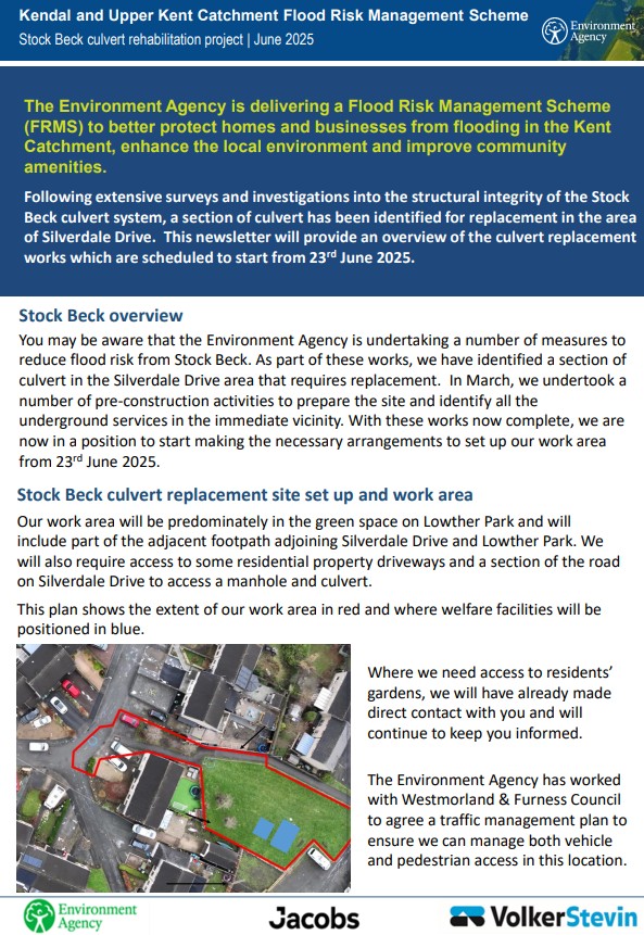
As part of the rehabilitation works on Stock Beck Culvert system, the Environment Agency have identified a section of culvert in the vicinity of Silverdale Drive that requires replacement. This work will be carried out this summer. Click here to find out more.
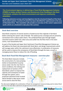
The Environment Agency are continuing their programme of surveys and investigations into the structural integrity of the Stock Beck culvert system, which will help them to understand ground conditions and the locations of any utility services around Ann Street.
This newsletter will provide an overview of the survey and investigation work. For more information, click here.
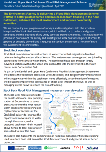
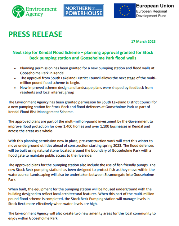
The Environment Agency received planning approval from South Lakeland District Council (now Westmorland and Furness Council) and common land consent from the Planning Inspectorate for construction of the new Stock Beck Pumping Station, associated flood defences and landscaping at Gooseholme in March 2023.
In the event water levels run high, the new pumping station will pump an increased volume of water from Stock Beck to ensure flood levels are managed more efficiently. By increasing the flow through the system and enabling discharge into the River Kent when river levels are high, we will reduce flood risk from the drainage system.
A number of new landscaping features will improve the area between Stramongate Bridge and Gooseholme Park which will integrate planting, sustainable drainage and seating.
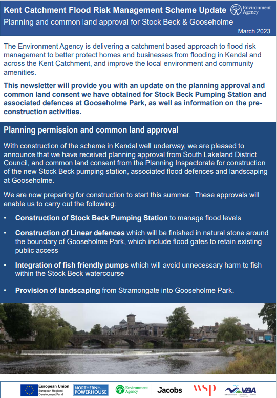
Stock Beck pumping station and Gooseholme Park planning approval
Alex – Environment Agency Project Manager
Sharon – Environment Agency Flood Risk Manager, Cumbria
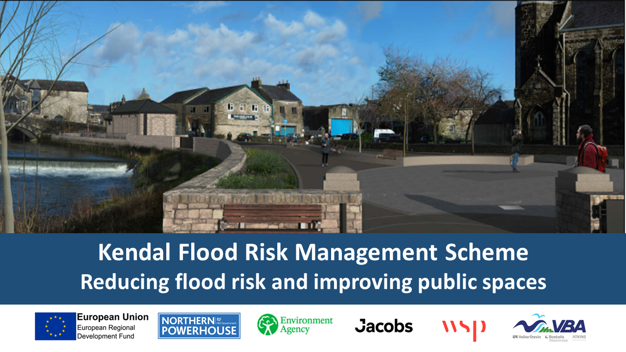
Click here to view a larger version of the visualisation
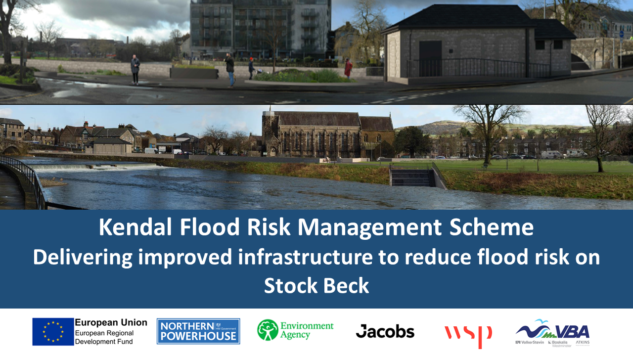
Click here to view a larger version of the visualisation
Click here to download the Little Aynam scheme completion briefing.
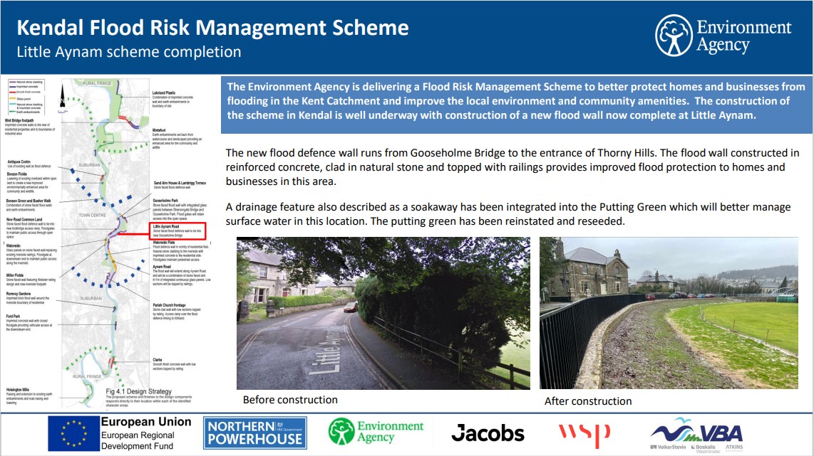
The Environment Agency is well underway with constructing the stone clad flood wall from Gooseholme Bridge to Miller Bridge. The Environment Agency are preparing to start construction of the next phase of works which will extend from Gooseholme Bridge to the entrance to Thorny Hills. The newsletter provides information on this next phase of works.
The scheme information board provides information on the full extent of works being delivered between Thorny Hills and Miller Bridge.
Click here to read the Environment Agency’s construction completion update.
Click here to read the Environment Agency’s construction update.
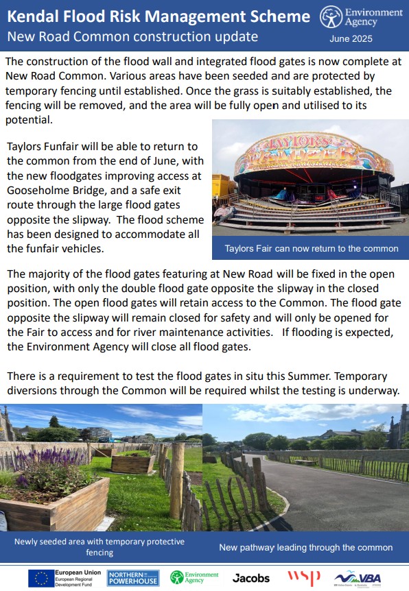
Click here to read the construction update.
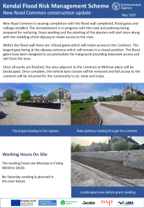
Click here to read the construction update
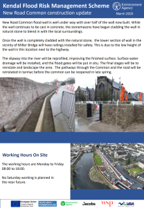
Click here to read the construction update

Work will be starting in early November to create the foundations for the new flood wall along New Road. Sheet piling is a technique used that drives long steel interlocking sheets into the ground, this method not only reduces groundwater flows but also creates a solid base to build the flood walls from. Find out more about this method here:
Click here to read the construction update.
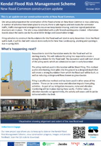
New Road Common planning application has been approved. Find out more about the works in this video.
Click here to read the update – September 2024
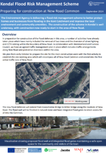
Following the Westmorland and Furness planning committee meeting on 12th September an approval decision has been made. Find out more below for what steps the Environment Agency will take to ‘prepare to start construction/review our options’. – September 2024
Planning application for flood defence works at Kendal’s New Road
Planning permission has been granted for a revised design for flood defences at New Road in Kendal by Westmorland and Furness Planning Authority following the planning committee deferring the application in May.
Feedback from local residents and interest groups on the original plans approved in 2019 as well as comments through the common land consultation shaped further improvements made to the flood scheme design by the Environment Agency.
The new design includes changes to the open aspect and accessibility through the area for both the local community and visitors. The approved design includes a safer Common access arrangement for the fairground and for other activities at the location.
The New Road flood wall complements the stonework and finish of Gooseholme Bridge and the wider flood scheme throughout Kendal, creating and maintaining a safe community green space with access for all.
The planning decision means work can now start on this section of the Kendal and Upper Kent Catchment Flood Risk Management Scheme which will better protect more than 1,920 homes and 2,250 local businesses from the impact of flooding.
Environment Agency Flood and Coastal Risk Manager, Richard Knight said:
“These changes to the original design have been made in response to the feedback from the community and interested parties. We listened, we duly considered local people’s requests, and we believe the new design will enhance the town whilst providing better protection to homes and businesses against the very real threat of flooding.
“Being granted planning permission for the New Road area heralds the start of the next part of the flood risk management scheme for Kendal.
“It is important to get the scheme built as quickly as possible to protect the homes and businesses in this area of Kendal.”
For more information about the Kendal flood scheme, visit the Information Hub at 2 Beezon Road adjacent to Lidl which is open to the public Tuesdays and Thursdays, 10.00 am to 4.00 pm.
Following the original planning approval in 2019 and subsequent feedback from the community and local interest groups, the Environment Agency have further improved the flood scheme design for New Road. The improved design will predominately reduce the height of the flood wall along New Road Common, improve the open aspect and accessibility through the area for both the local community and visitors to the town, and includes a safer Common access arrangement for the Fairground and for other operational activities.
The proposed flood wall complements the stonework and finish of Gooseholme Bridge and the wider flood scheme throughout Kendal, creating and maintaining a safe community green space with access for all.
The below visualisations show the proposed flood scheme from a Southerly and Northerly viewpoint of New Road Common:

Click here to view the existing view and full visualisation

Click here to view the proposed view and full visualisation

Click here to view the existing view and full visualisation

Click here to view the proposed view and full visualisation
A summary of the Scheme design is here
These improvements have been submitted to Westmorland and Furness Planning Authority as a planning application which is currently being determined. You can visit the planning portal to access further information here Planning application: 2024/0216/FPA | Westmorland & Furness Council (westmorlandandfurness.gov.uk).
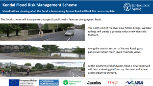
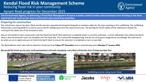
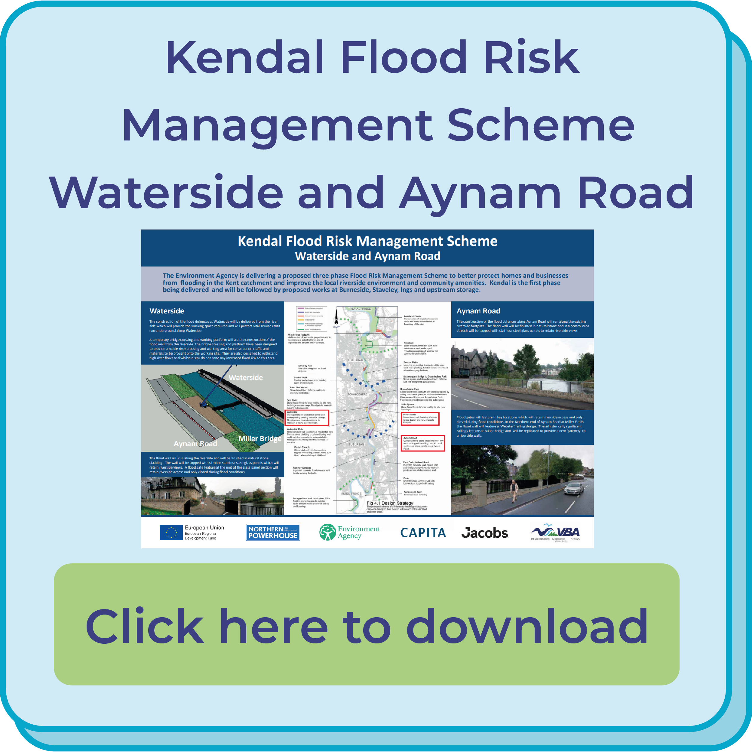
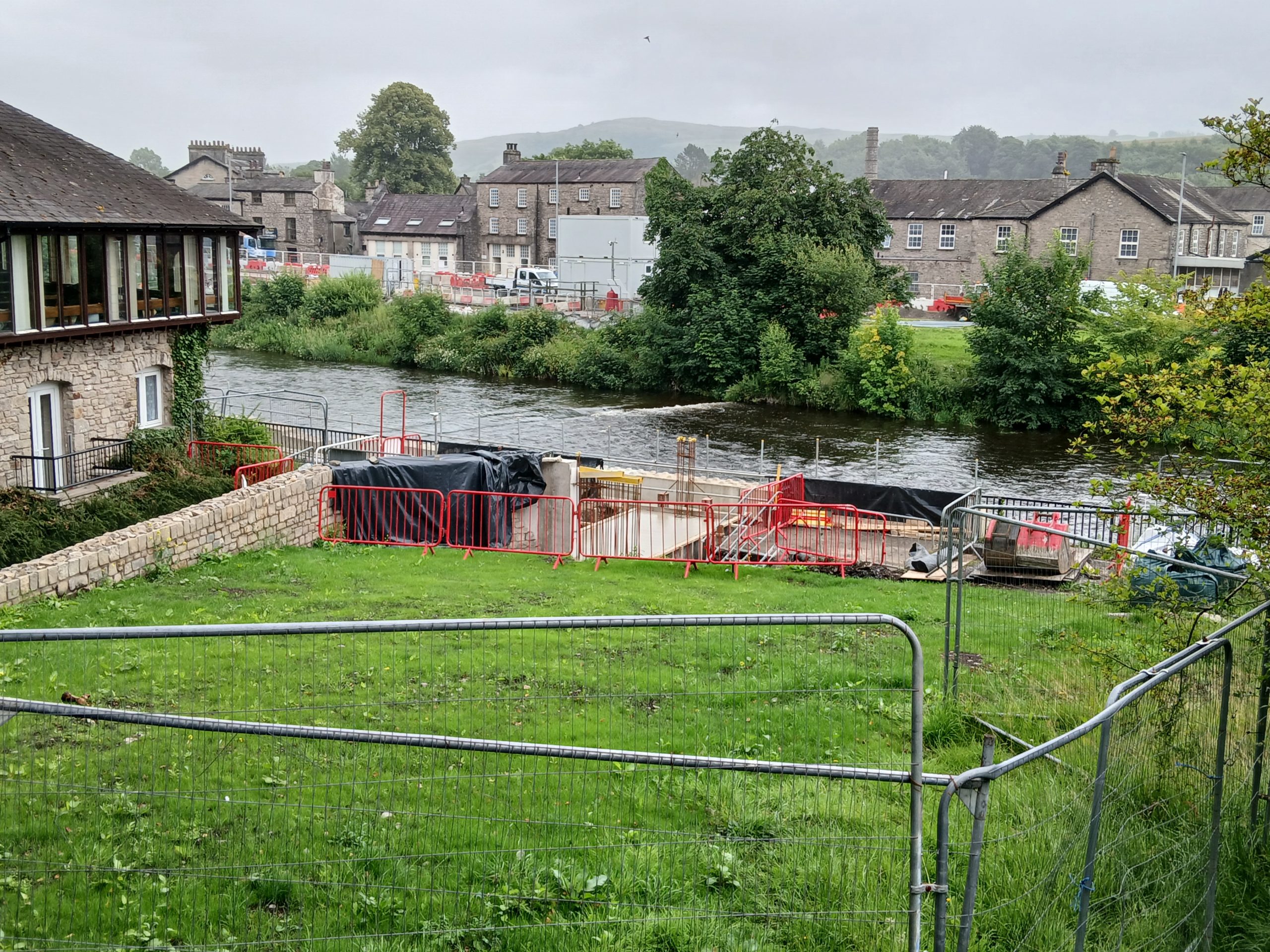
In order to construct the glass panelled flood wall along Waterside, the Environment Agency have been constructing a temporary bridge which extends across the river from Miller Fields to Waterside. The temporary bridge will provide the access required across the river to construct the working platform which will provide the safe working area required to construct the flood wall. The temporary in-river bridge and platform are currently being constructed and has included the installation of three piers built into the river bed and topped with the bridge deck. The bridge crossing and working platforms have been designed to be safe even during high river levels.
Read the full press release for more information here.
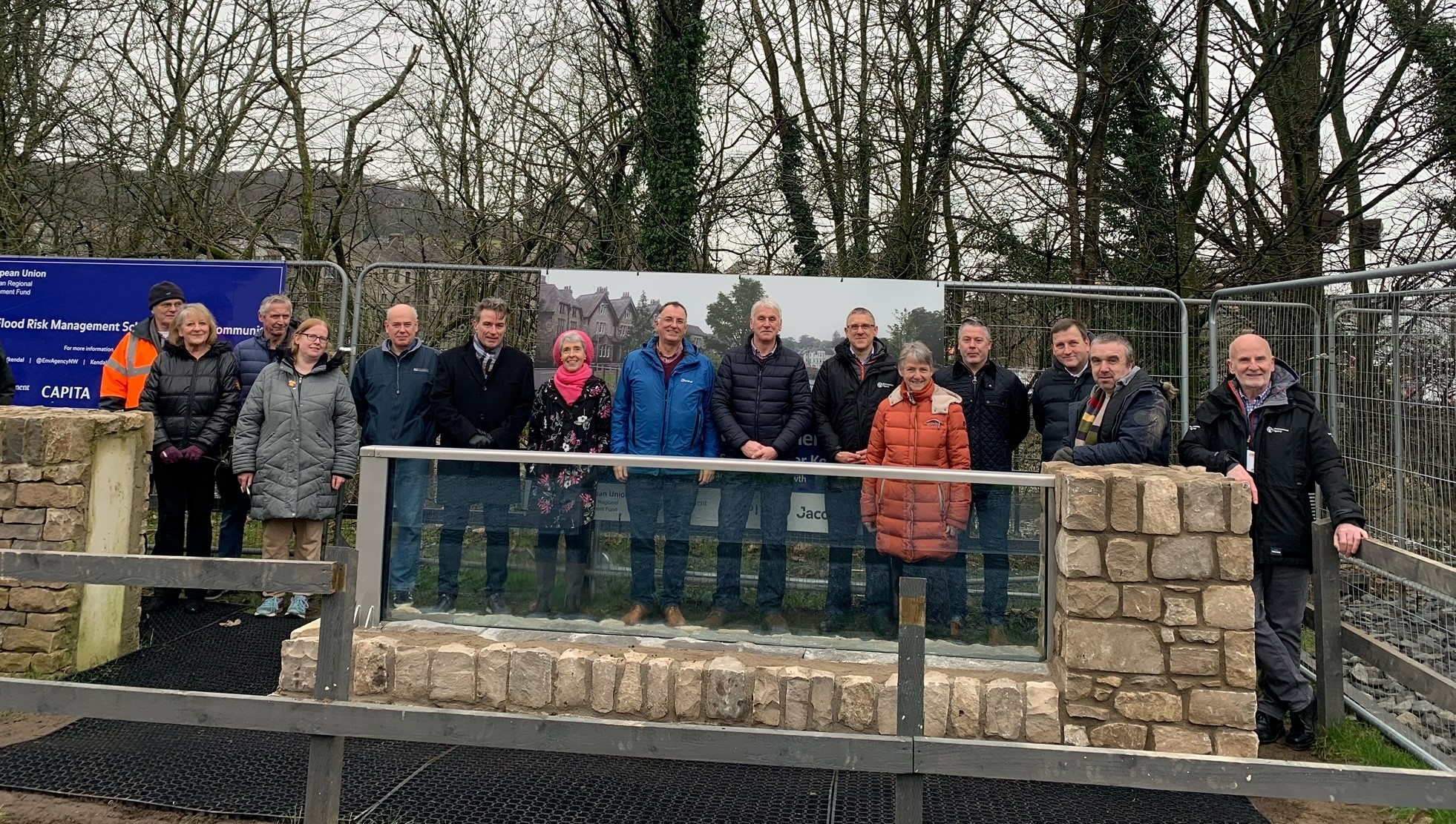
Representatives from Kendal Town Council, Environment Agency, Volkerstevin and Kendal Flood Action Group join representatives from the glass panel suppliers Pilkington, Flood Control and Sentry Glass to view panel.
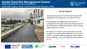
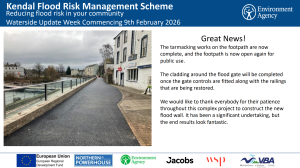
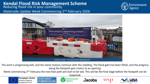
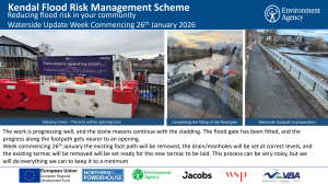
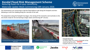
Watch the video below for an update on the work being carried out at Waterside.
The second pile trial activity to further test the piling method for the foundation of the flood wall along Waterside has successfully been completed. This took place over two weeks during November 2024.
The trial was undertaken by Volker Stevin, Volker Ground Engineering and Keller using a specialist piling rig and supporting equipment. The technique trialled is known as a ‘down the hole hammer’ and used two methods which were;
Between now and into the early New Year, the data and information gathered from trialling these two techniques will be assessed and scrutinised. It is our intention that through this process we will be able to determine the most appropriate method to begin the piled foundations for the flood wall in Spring 2025.
Working with Kendal Town Council and Kendal Conservation Volunteers, reinstatement of Summerville Gardens adjacent to Edgecombe court will undergo landscaping. This landscaping, delivered by Ashley the Environment Agency’s sub-contractor, will include reseeding of the grass and planting of a selection of bulbs and plants. The planting will be suitable to the riverside location providing habitat for wildlife as well as enhancing the public amenity area. The riverside footpath will continue to be open during this time.
Find out more about the highly designed glass panels which are being installed at Waterside. A key feature of the Kendal Flood Risk Management Scheme which not only offers flood protection but retains views of the riverside.
 In order to construct the glass panelled flood wall along Waterside, the Environment Agency have been constructing a temporary bridge which extends across the river from Miller Fields to Waterside. The temporary bridge will provide the access required across the river to construct the working platform which will provide the safe working area required to construct the flood wall. The temporary in-river bridge and platform are currently being constructed and has included the installation of three piers built into the river bed and topped with the bridge deck. The bridge crossing and working platforms have been designed to be safe even during high river levels.
Click here to download the completion update – September 2024
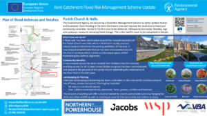
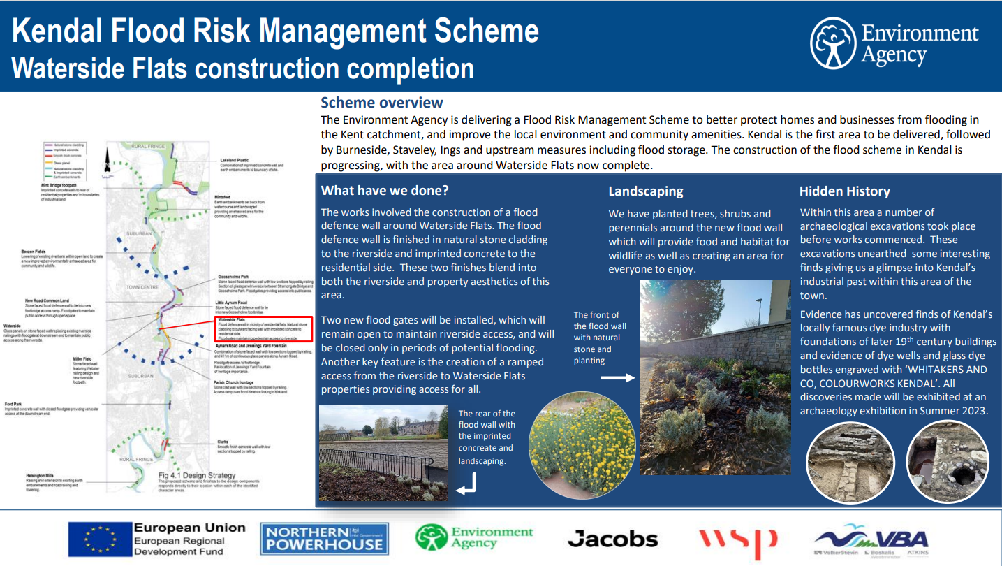
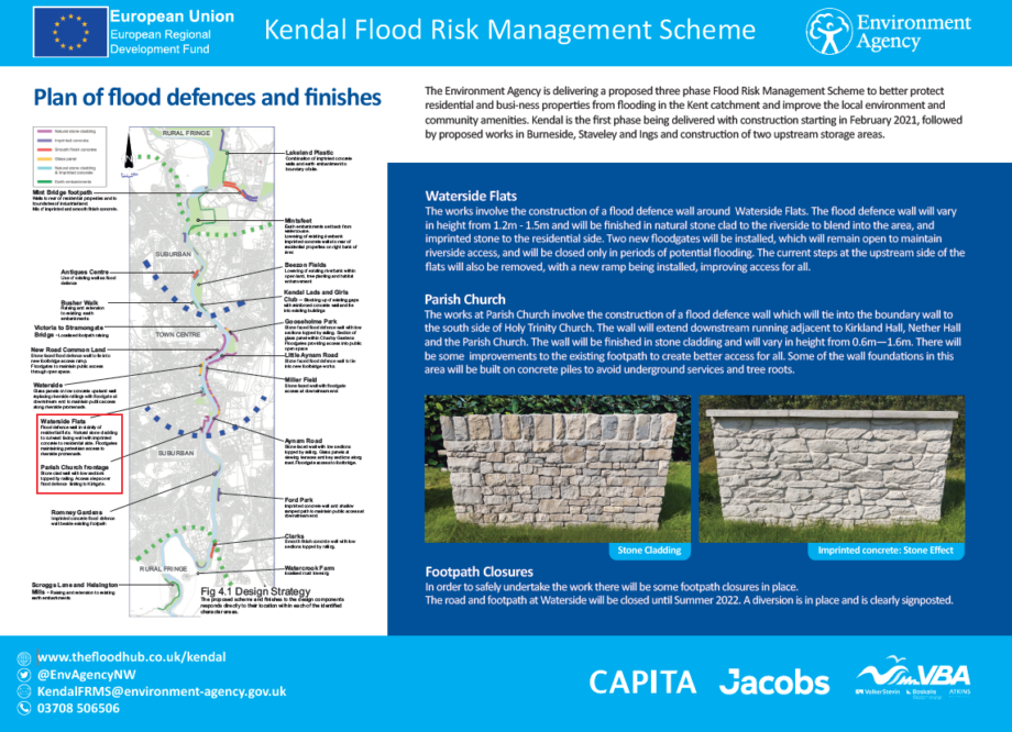
Waterside Flats is the seventh section of work to be completed in Kendal. This section of flood defence comprises of the construction of a flood wall finished in a combination of imprinted concrete to the residential side and natural stone to the riverside to blend into the local area. Additional features include the integration of flood gates and a new ramped access improving and retaining connectivity from the riverside to the town.
Click here to download the Waterside Flats construction completion update.
Click here to download the Waterside Flats completed work press release.
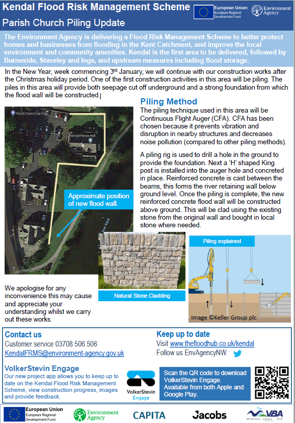
In the New Year, week commencing 3rd January, the Environment Agency will continue with their construction works after the Christmas holiday period. One of the first construction activities in this area will be piling. The piles in this area will provide both seepage cut off underground and a strong foundation from which the flood wall will be constructed.
Click here to download a copy of the document above
Click here to download a copy of the document above.
Click here to return to the Kendal Flood Risk Management Scheme page
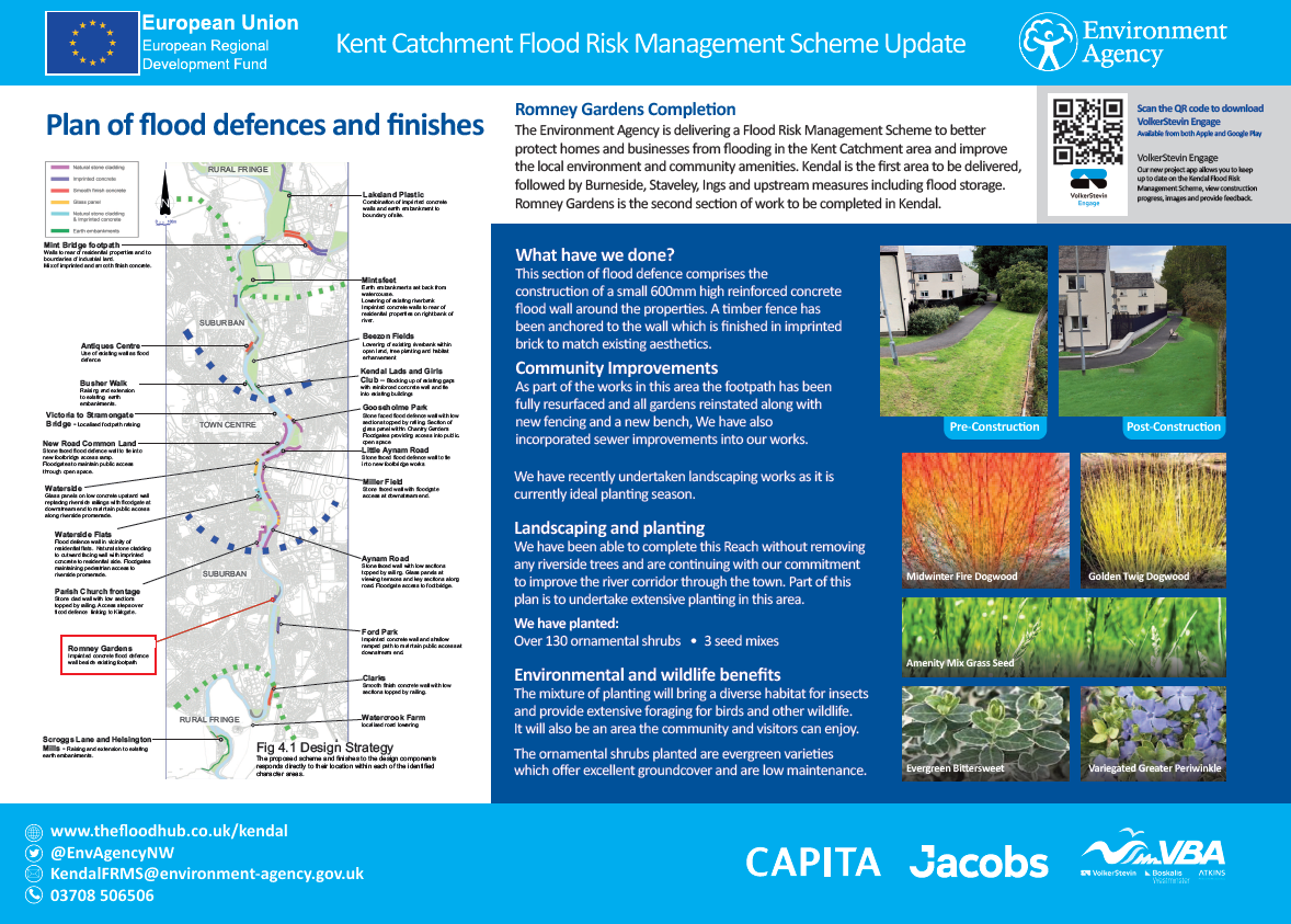
Romney Gardens is the second section of work to be completed in Kendal. This section of flood defence comprises of the construction of a small reinforced concrete flood wall around the properties. The wall finished in imprinted brick and new replacement timber fence matches the existing aesthetics. See below for more information about the work that has been completed.
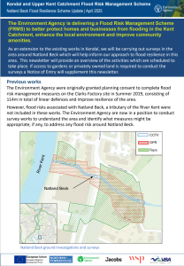
As an extension to the existing works in Kendal, the Environment Agency will be carrying out surveys in the area around Natland Beck which will help inform their approach to flood resilience in this area.
This newsletter will provide an overview of the activities. For more information, click here.

To download a copy of the document above, please click here.
Natand Road is the third section of work to be completed in Kendal. This section of flood defence involved the construction of a small flood wall along the riverside footpath finished in imprinted stone. A section of concrete kerb has also been installed which ties into the new flood defence wall. For more information about the work that has been completed at Natland Road. download the Environment Agency document below:
Press release from the Environment Agency 20/12/21
Work on the flood defences at Clarks as part the Kendal Flood Risk Management Scheme are now complete. The area now benefits from 114m of flood defences and a new flood wall, as well as a range of community improvements with an area of grassland restored and a seating area reinstated.
Work on the flood defences at Clarks as part the Kendal Flood Risk Management Scheme are now complete. The area now benefits from 114m of flood defences and a new flood wall, as well as a range of community improvements with an area of grassland restored and a seating area reinstated.
The £76million flood scheme will see a number of landscaping, planting and environmental benefits throughout the town as works continue to progress. Seven trees and a grass seed mix have been carefully planted at Clarks providing ideal habitats for local wildlife.
When complete, the Kendal Flood Risk Management Scheme will better protect 1,400 homes and 1,100 business from flooding.
Stewart Mounsey, Flood Risk Manager for Cumbria said,
“Since construction started in the town in February 2021, flood defence work has been completed at four key locations Dockray Hall, Romney Gardens, Natland Road and now Clarks. We conclude our work this year by continuing with our commitment to improve the river corridor and plant over 4,000 trees across the town.
“Work on site will be coming to a close for the Christmas period over the next few days and we will be back in town in early January with construction continuing at Parish Church and Waterside Flats. Construction works will also be starting at Busher Walk and Beezon Fields which is scheduled to start early in the New Year.”
With winter approaching it’s vital everyone knows how flooding can affect them and how to keep loved ones, property and possession safe. Go to the Gov.uk website or search ‘know my flood risk’ to sign up for Environment Agency flood warnings, receive information on the risk in your area and what to do in a flood.
To keep up to date on the Kendal Flood Risk Management Scheme, visit www.thefloodhub.co.uk/Kendal follow us on Twitter account @EnvAgencyNW or download the new VolkerStevin Engage App
Flood defence works at Clarks is the fourth section of work to be completed in Kendal. This section of flood defence comprises of approximately 114m in total of linear defences. This includes two sections of raised kerb at the north and south end of the site, finished with a central section of flood wall. Download the Environment Agency document below for more information.
To protect the community of Helsington the Environment Agency have constructed approximately 376m of linear flood defences comprising of walls and embankments and sections of road raising. This is the fifth reach to be completed in Kendal.
Helsington Mills is the fifth section of the Kendal Flood Risk Management Scheme to be completed. To protect the community of Helsington, the Environment Agency have constructed approximately 376m of linear flood defences comprising of walls and embankments and sections of road raising. They have greatly improved the surfacing to the existing car park at the bottom of Scroggs Lane and are supporting Kendal Conservation Volunteers in planting an additional 1000 trees providing multiple environment and community benefits. Download the document below for more information:
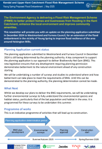
In the vicinity of Helsington Mills, the Environment Agency are proposing an extension to the existing completed flood embankment to provide additional protection from Young Spring. The proposed flood embankment will tie into the existing flood embankment to provide additional protection to the community of Helsington Mills.

The Environment Agency are looking for opportunities to enhance the River Kent corridor, within the location of Barley Bridge. During September the first part of this work will be to undertake a survey carried out by a specialist dive team. The survey will help us to understand the structural integrity of existing structures above and below the water level around Barley Bridge Weir.
Click here for more information.
